Class information for: |
Basic class information |
| Class id | #P | Avg. number of references |
Database coverage of references |
|---|---|---|---|
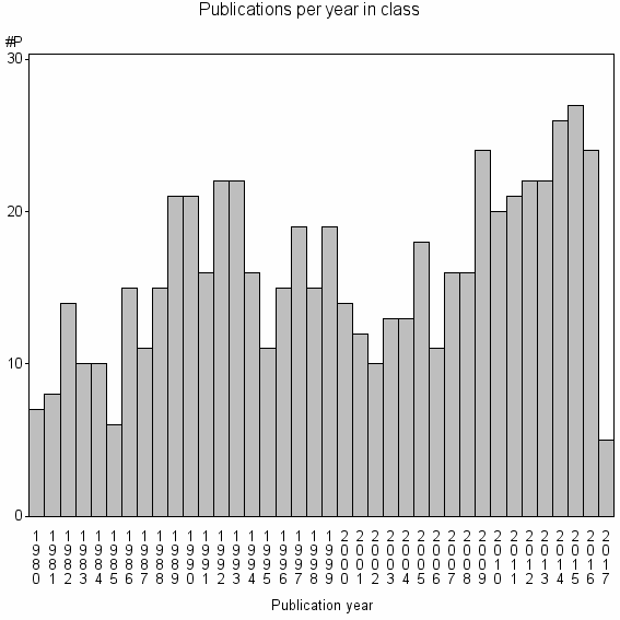
| 17290 | 607 | 29.4 | 20% |
Hierarchy of classes |
The table includes all classes above and classes immediately below the current class. |
| Cluster id | Level | Cluster label | #P |
|---|---|---|---|
| 1 | 4 | ECONOMICS//EDUCATION & EDUCATIONAL RESEARCH//PSYCHOL | 3876184 |
| 421 | 3 | ERGONOMICS//HUMAN FACTORS//IEEE TRANSACTIONS ON VISUALIZATION AND COMPUTER GRAPHICS | 28487 |
| 1482 | 2 | CARTOGRAPHIC JOURNAL//INTERNATIONAL JOURNAL OF GEOGRAPHICAL INFORMATION SCIENCE//QUALITATIVE SPATIAL REASONING | 7638 |
| 17290 | 1 | CARTOGRAPHIC JOURNAL//AMERICAN CARTOGRAPHER//MAP DESIGN | 607 |
Terms with highest relevance score |
| rank | Term | termType | Chi square | Shr. of publ. in class containing term |
Class's shr. of term's tot. occurrences |
#P with term in class |
|---|---|---|---|---|---|---|
| 1 | CARTOGRAPHIC JOURNAL | journal | 1909280 | 23% | 27% | 139 |
| 2 | AMERICAN CARTOGRAPHER | journal | 855960 | 7% | 38% | 45 |
| 3 | MAP DESIGN | authKW | 321927 | 3% | 40% | 16 |
| 4 | CHOROPLETH MAPS | authKW | 295898 | 2% | 59% | 10 |
| 5 | CHOROPLETH MAPPING | authKW | 150912 | 0% | 100% | 3 |
| 6 | FIXATION IDENTIFICATION | authKW | 150912 | 0% | 100% | 3 |
| 7 | PERSUASIVE MAPS | authKW | 150912 | 0% | 100% | 3 |
| 8 | CARTOGRAPHY | authKW | 118905 | 5% | 7% | 32 |
| 9 | CARTOGRAPHY AND GEOGRAPHIC INFORMATION SYSTEMS | journal | 118731 | 2% | 20% | 12 |
| 10 | DYNAMIC MAPS | authKW | 114977 | 1% | 57% | 4 |
Web of Science journal categories |
| Rank | Term | Chi square | Shr. of publ. in class containing term |
Class's shr. of term's tot. occurrences |
#P with term in class |
|---|---|---|---|---|---|
| 1 | Geography | 87215 | 56% | 1% | 337 |
| 2 | Information Science & Library Science | 1919 | 9% | 0% | 55 |
| 3 | Geography, Physical | 1216 | 8% | 0% | 47 |
| 4 | Computer Science, Information Systems | 767 | 10% | 0% | 59 |
| 5 | Computer Science, Software Engineering | 407 | 6% | 0% | 39 |
| 6 | Remote Sensing | 356 | 3% | 0% | 21 |
| 7 | Ergonomics | 135 | 1% | 0% | 9 |
| 8 | Geosciences, Multidisciplinary | 104 | 6% | 0% | 36 |
| 9 | Computer Science, Interdisciplinary Applications | 101 | 4% | 0% | 25 |
| 10 | Environmental Studies | 90 | 2% | 0% | 15 |
Address terms |
| Rank | Term | Chi square | Shr. of publ. in class containing term |
Class's shr. of term's tot. occurrences |
#P with term in class |
|---|---|---|---|---|---|
| 1 | CARTOG GEOMAT | 67071 | 0% | 67% | 2 |
| 2 | TACTILE INKJET M PING PROJECT | 67071 | 0% | 67% | 2 |
| 3 | ATLAS CANADA PROGRAM | 50304 | 0% | 100% | 1 |
| 4 | CARTOG DEV | 50304 | 0% | 100% | 1 |
| 5 | CICSNOVA | 50304 | 0% | 100% | 1 |
| 6 | CYMAL MUSEUMS ARCH LIB WALES | 50304 | 0% | 100% | 1 |
| 7 | DUTTON E EDUC GEOVISTA | 50304 | 0% | 100% | 1 |
| 8 | ECOL GERENCIANAENTO ECOSSISTEMAS COSTEIROS | 50304 | 0% | 100% | 1 |
| 9 | FCSHUNL | 50304 | 0% | 100% | 1 |
| 10 | FITKI ARTIFICIAL INTELLIGENCE | 50304 | 0% | 100% | 1 |
Journals |
| Rank | Term | Chi square | Shr. of publ. in class containing term |
Class's shr. of term's tot. occurrences |
#P with term in class |
|---|---|---|---|---|---|
| 1 | CARTOGRAPHIC JOURNAL | 1909280 | 23% | 27% | 139 |
| 2 | AMERICAN CARTOGRAPHER | 855960 | 7% | 38% | 45 |
| 3 | CARTOGRAPHY AND GEOGRAPHIC INFORMATION SYSTEMS | 118731 | 2% | 20% | 12 |
| 4 | CARTOGRAPHY AND GEOGRAPHIC INFORMATION SCIENCE | 111301 | 4% | 10% | 23 |
| 5 | INTERNATIONAL JOURNAL OF GEOGRAPHICAL INFORMATION SYSTEMS | 24640 | 2% | 5% | 10 |
| 6 | GEO-PROCESSING | 18859 | 0% | 13% | 3 |
| 7 | INTERNATIONAL JOURNAL OF GEOGRAPHICAL INFORMATION SCIENCE | 15216 | 3% | 1% | 21 |
| 8 | JOURNAL OF EYE MOVEMENT RESEARCH | 13456 | 1% | 4% | 7 |
| 9 | ANNALS OF THE ASSOCIATION OF AMERICAN GEOGRAPHERS | 12942 | 3% | 1% | 20 |
| 10 | BOLETIM DE CIENCIAS GEODESICAS | 5681 | 1% | 2% | 5 |
Author Key Words |
| Rank | Term | Chi square | Shr. of publ. in class containing term |
Class's shr. of term's tot. occurrences |
#P with term in class |
LCSH search | Wikipedia search |
|---|---|---|---|---|---|---|---|
| 1 | MAP DESIGN | 321927 | 3% | 40% | 16 | Search MAP+DESIGN | Search MAP+DESIGN |
| 2 | CHOROPLETH MAPS | 295898 | 2% | 59% | 10 | Search CHOROPLETH+MAPS | Search CHOROPLETH+MAPS |
| 3 | CHOROPLETH MAPPING | 150912 | 0% | 100% | 3 | Search CHOROPLETH+MAPPING | Search CHOROPLETH+MAPPING |
| 4 | FIXATION IDENTIFICATION | 150912 | 0% | 100% | 3 | Search FIXATION+IDENTIFICATION | Search FIXATION+IDENTIFICATION |
| 5 | PERSUASIVE MAPS | 150912 | 0% | 100% | 3 | Search PERSUASIVE+MAPS | Search PERSUASIVE+MAPS |
| 6 | CARTOGRAPHY | 118905 | 5% | 7% | 32 | Search CARTOGRAPHY | Search CARTOGRAPHY |
| 7 | DYNAMIC MAPS | 114977 | 1% | 57% | 4 | Search DYNAMIC+MAPS | Search DYNAMIC+MAPS |
| 8 | MULTIMEDIA CARTOGRAPHY | 113183 | 0% | 75% | 3 | Search MULTIMEDIA+CARTOGRAPHY | Search MULTIMEDIA+CARTOGRAPHY |
| 9 | EYE MOVEMENT ANALYSIS | 106519 | 1% | 35% | 6 | Search EYE+MOVEMENT+ANALYSIS | Search EYE+MOVEMENT+ANALYSIS |
| 10 | CARTOGRAPHIC ANIMATIONS | 100608 | 0% | 100% | 2 | Search CARTOGRAPHIC+ANIMATIONS | Search CARTOGRAPHIC+ANIMATIONS |
Core articles |
The table includes core articles in the class. The following variables is taken into account for the relevance score of an article in a cluster c: (1) Number of references referring to publications in the class. (2) Share of total number of active references referring to publications in the class. (3) Age of the article. New articles get higher score than old articles. (4) Citation rate, normalized to year. |
| Rank | Reference | # ref. in cl. |
Shr. of ref. in cl. |
Citations |
|---|---|---|---|---|
| 1 | FIELD, K , KENT, AJ , (2015) FIFTY YEARS OF THE CARTOGRAPHIC JOURNAL.CARTOGRAPHIC JOURNAL. VOL. 52. ISSUE 3. P. 228 -231 | 23 | 66% | 1 |
| 2 | BREWER, CA , PICKLE, L , (2002) EVALUATION OF METHODS FOR CLASSIFYING EPIDEMIOLOGICAL DATA ON CHOROPLETH MAPS IN SERIES.ANNALS OF THE ASSOCIATION OF AMERICAN GEOGRAPHERS. VOL. 92. ISSUE 4. P. 662-681 | 21 | 84% | 58 |
| 3 | STEWART, J , KENNELLY, PJ , (2010) ILLUMINATED CHOROPLETH MAPS.ANNALS OF THE ASSOCIATION OF AMERICAN GEOGRAPHERS. VOL. 100. ISSUE 3. P. 513-534 | 13 | 81% | 3 |
| 4 | KRASSANAKIS, V , FILIPPAKOPOULOU, V , NAKOS, B , (2016) DETECTION OF MOVING POINT SYMBOLS ON CARTOGRAPHIC BACKGROUNDS.JOURNAL OF EYE MOVEMENT RESEARCH. VOL. 9. ISSUE 2. P. - | 12 | 75% | 0 |
| 5 | CYBULSKI, P , (2016) DESIGN RULES AND PRACTICES FOR ANIMATED MAPS ONLINE.JOURNAL OF SPATIAL SCIENCE. VOL. 61. ISSUE 2. P. 461 -471 | 9 | 90% | 0 |
| 6 | DONG, WH , LIAO, H , XU, F , LIU, Z , ZHANG, SB , (2014) USING EYE TRACKING TO EVALUATE THE USABILITY OF ANIMATED MAPS.SCIENCE CHINA-EARTH SCIENCES. VOL. 57. ISSUE 3. P. 512 -522 | 11 | 73% | 4 |
| 7 | LAI, PC , YEH, AGO , (2004) ASSESSING THE EFFECTIVENESS OF DYNAMIC SYMBOLS IN CARTOGRAPHIC COMMUNICATION.CARTOGRAPHIC JOURNAL. VOL. 41. ISSUE 3. P. 229 -244 | 11 | 92% | 9 |
| 8 | GOLEBIOWSKA, I , OPACH, T , ROD, JK , (2017) FOR YOUR EYES ONLY? EVALUATING A COORDINATED AND MULTIPLE VIEWS TOOL WITH A MAP, A PARALLEL COORDINATED PLOT AND A TABLE USING AN EYE-TRACKING APPROACH.INTERNATIONAL JOURNAL OF GEOGRAPHICAL INFORMATION SCIENCE. VOL. 31. ISSUE 2. P. 237 -252 | 11 | 65% | 0 |
| 9 | KOSTELNICK, JC , DOBSON, JE , EGBERT, SL , DUNBAR, MD , (2008) CARTOGRAPHIC SYMBOLS FOR HUMANITARIAN DEMINING.CARTOGRAPHIC JOURNAL. VOL. 45. ISSUE 1. P. 18-31 | 8 | 100% | 9 |
| 10 | DONG, WH , RAN, J , WANG, J , (2012) EFFECTIVENESS AND EFFICIENCY OF MAP SYMBOLS FOR DYNAMIC GEOGRAPHIC INFORMATION VISUALIZATION.CARTOGRAPHY AND GEOGRAPHIC INFORMATION SCIENCE. VOL. 39. ISSUE 2. P. 98-106 | 8 | 80% | 5 |
Classes with closest relation at Level 1 |