Class information for: |
Basic class information |
| ID | Publications | Average number of references |
Avg. shr. active ref. in WoS |
|---|---|---|---|
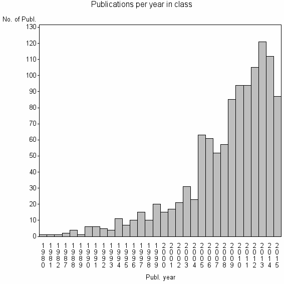
| 8863 | 1142 | 31.8 | 32% |
Classes in level above (level 2) |
| ID, lev. above |
Publications | Label for level above |
|---|---|---|
| 1769 | 5851 | INTERNATIONAL JOURNAL OF GEOGRAPHICAL INFORMATION SCIENCE//CARTOGRAPHIC JOURNAL//QUALITATIVE SPATIAL REASONING |
Terms with highest relevance score |
| Rank | Term | Type of term | Relevance score (tfidf) |
Class's shr. of term's tot. occurrences |
Shr. of publ. in class containing term |
Num. of publ. in class |
|---|---|---|---|---|---|---|
| 1 | SPATIAL INFORMAT SCI SYST | Address | 25 | 60% | 2% | 27 |
| 2 | JOINT INTELLIGENT SPATIAL COMP | Address | 17 | 79% | 1% | 11 |
| 3 | SENSOR WEB | Author keyword | 15 | 31% | 4% | 41 |
| 4 | CSISS | Address | 14 | 53% | 2% | 19 |
| 5 | INTERNATIONAL JOURNAL OF DIGITAL EARTH | Journal | 12 | 19% | 5% | 56 |
| 6 | OPENMI | Author keyword | 9 | 52% | 1% | 12 |
| 7 | DIGITAL EARTH | Author keyword | 7 | 22% | 2% | 28 |
| 8 | INTELLIGENT SPATIAL COMP | Address | 6 | 80% | 0% | 4 |
| 9 | SPATIAL DATA INFRASTRUCTURE | Author keyword | 6 | 21% | 2% | 25 |
| 10 | SPATIAL DATA INFRASTRUCTURES | Author keyword | 6 | 33% | 1% | 15 |
Web of Science journal categories |
Author Key Words |
| Rank | Web of Science journal category | Relevance score (tfidf) |
Class's shr. of term's tot. occurrences |
Shr. of publ. in class containing term |
Num. of publ. in class |
LCSH search | Wikipedia search |
|---|---|---|---|---|---|---|---|
| 1 | SENSOR WEB | 15 | 31% | 4% | 41 | Search SENSOR+WEB | Search SENSOR+WEB |
| 2 | OPENMI | 9 | 52% | 1% | 12 | Search OPENMI | Search OPENMI |
| 3 | DIGITAL EARTH | 7 | 22% | 2% | 28 | Search DIGITAL+EARTH | Search DIGITAL+EARTH |
| 4 | SPATIAL DATA INFRASTRUCTURE | 6 | 21% | 2% | 25 | Search SPATIAL+DATA+INFRASTRUCTURE | Search SPATIAL+DATA+INFRASTRUCTURE |
| 5 | SPATIAL DATA INFRASTRUCTURES | 6 | 33% | 1% | 15 | Search SPATIAL+DATA+INFRASTRUCTURES | Search SPATIAL+DATA+INFRASTRUCTURES |
| 6 | OPEN GEOSPATIAL CONSORTIUM | 6 | 39% | 1% | 12 | Search OPEN+GEOSPATIAL+CONSORTIUM | Search OPEN+GEOSPATIAL+CONSORTIUM |
| 7 | DIGITAL CHINA | 6 | 100% | 0% | 4 | Search DIGITAL+CHINA | Search DIGITAL+CHINA |
| 8 | OGC WEB SERVICES | 6 | 50% | 1% | 8 | Search OGC+WEB+SERVICES | Search OGC+WEB+SERVICES |
| 9 | SPATIOTEMPORAL THINKING AND COMPUTING | 6 | 100% | 0% | 4 | Search SPATIOTEMPORAL+THINKING+AND+COMPUTING | Search SPATIOTEMPORAL+THINKING+AND+COMPUTING |
| 10 | GEOSPATIAL CYBERINFRASTRUCTURE | 5 | 60% | 1% | 6 | Search GEOSPATIAL+CYBERINFRASTRUCTURE | Search GEOSPATIAL+CYBERINFRASTRUCTURE |
Key Words Plus |
| Rank | Web of Science journal category | Relevance score (tfidf) |
Class's shr. of term's tot. occurrences |
Shr. of publ. in class containing term |
Num. of publ. in class |
|---|---|---|---|---|---|
| 1 | GEOSPATIAL CYBERINFRASTRUCTURE | 15 | 88% | 1% | 7 |
| 2 | OPENMI | 9 | 64% | 1% | 9 |
| 3 | SPATIAL DATA INFRASTRUCTURES | 9 | 47% | 1% | 14 |
| 4 | GEOGRAPHIC INFORMATION | 8 | 22% | 3% | 34 |
| 5 | CYBERINFRASTRUCTURE | 8 | 31% | 2% | 21 |
| 6 | DIGITAL EARTH | 6 | 35% | 1% | 15 |
| 7 | SPATIAL DATA INFRASTRUCTURE | 6 | 71% | 0% | 5 |
| 8 | WEB ENABLEMENT | 6 | 71% | 0% | 5 |
| 9 | WATER DATA | 6 | 100% | 0% | 4 |
| 10 | MULTIPARADIGM | 5 | 63% | 0% | 5 |
Journals |
| Rank | Web of Science journal category | Relevance score (tfidf) |
Class's shr. of term's tot. occurrences |
Shr. of publ. in class containing term |
Num. of publ. in class |
|---|---|---|---|---|---|
| 1 | INTERNATIONAL JOURNAL OF DIGITAL EARTH | 12 | 19% | 5% | 56 |
| 2 | EARTH SCIENCE INFORMATICS | 4 | 14% | 2% | 26 |
Reviews |
| Title | Publ. year | Cit. | Active references |
% act. ref. to same field |
|---|---|---|---|---|
| Web technologies for environmental Big Data | 2015 | 3 | 32 | 56% |
| New Generation Sensor Web Enablement | 2011 | 81 | 18 | 33% |
| Digital Earth: decadal experiences and some thoughts | 2010 | 17 | 2 | 100% |
| Progress and challenges in the architecture and service pattern of Earth Observation Sensor Web for Digital Earth | 2014 | 1 | 11 | 82% |
| Opportunities and Impediments for Open GIS | 2014 | 4 | 23 | 30% |
| Modelling with knowledge: A review of emerging semantic approaches to environmental modelling | 2009 | 45 | 26 | 31% |
| Deliberative processes for comprehensive evaluation of agroecological models. A review | 2015 | 1 | 58 | 21% |
| Geospatial Cyberinfrastructure and Geoprocessing Web-A Review of Commonalities and Differences of E-Science Approaches | 2013 | 1 | 14 | 93% |
| Scientific big data and Digital Earth | 2014 | 2 | 18 | 33% |
| Seeing the forest through the trees: A review of integrated environmental modelling tools | 2013 | 4 | 60 | 50% |
Address terms |
| Rank | Address term | Relevance score (tfidf) |
Class's shr. of term's tot. occurrences |
Shr. of publ. in class containing term |
Num. of publ. in class |
|---|---|---|---|---|---|
| 1 | SPATIAL INFORMAT SCI SYST | 25 | 60% | 2.4% | 27 |
| 2 | JOINT INTELLIGENT SPATIAL COMP | 17 | 79% | 1.0% | 11 |
| 3 | CSISS | 14 | 53% | 1.7% | 19 |
| 4 | INTELLIGENT SPATIAL COMP | 6 | 80% | 0.4% | 4 |
| 5 | DIGITAL EARTH REFERENCE DATA UNIT | 4 | 67% | 0.4% | 4 |
| 6 | NSF SPATIOTEMPORAL INNOVAT | 4 | 75% | 0.3% | 3 |
| 7 | UNIDATA PROGRAM | 3 | 57% | 0.4% | 4 |
| 8 | ENVIRONM DATA ARCHIVAL | 3 | 100% | 0.3% | 3 |
| 9 | LIESMARS | 3 | 30% | 0.7% | 8 |
| 10 | INTELLIGENT SPATIAL COMP WATER ENERGY SCI | 3 | 60% | 0.3% | 3 |
Related classes at same level (level 1) |
| Rank | Relatedness score | Related classes |
|---|---|---|
| 1 | 0.0000183592 | SPATIAL OPINION EXCHANGE//DISTRIBUTED HIGH PERFORMANCE COMP GRP//GEOSPATIAL CYBERINFRASTRUCTURE |
| 2 | 0.0000163578 | DONALD SMITS INFORMAT TECHNOL//EMINERALS//DATA PROVENANCE |
| 3 | 0.0000152087 | LONG TERM ECOL NETWORK OFF//LTER NETWORK//GENERAL OR MISCELLANEOUS NEW FIELDS NOT CLASSIFIABLE UNDER OTHER HEADINGS |
| 4 | 0.0000139859 | SPATIAL DATA TRANSFER STANDARD//SPATIAL QUERY PROCESSING AND DATA MINING//GTUB |
| 5 | 0.0000131613 | ANALYTICAL KNOWLEDGE//SUI CHANNELS//BRIDGE DECK PANEL |
| 6 | 0.0000097305 | VOLUNTEERED GEOGRAPHIC INFORMATION//CONFLATION//OPENSTREETMAP |
| 7 | 0.0000082290 | QUALITATIVE SPATIAL REASONING//REGION CONNECTION CALCULUS//TOPOLOGICAL RELATIONS |
| 8 | 0.0000076791 | COMMUNITY GRID S//REGRESSION BENCHMARKING//CHART LUTIN COGNIT HUMAINE ARTIFICIELLE |
| 9 | 0.0000076009 | CARTOGRAPHIC GENERALIZATION//MAP GENERALISATION//MAP GENERALIZATION |
| 10 | 0.0000070377 | PPGIS//PARTICIPATORY GIS//PUBLIC PARTICIPATION GIS |