Class information for: |
Basic class information |
| ID | Publications | Average number of references |
Avg. shr. active ref. in WoS |
|---|---|---|---|
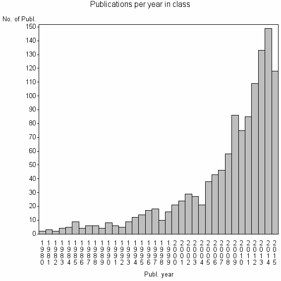
| 8065 | 1222 | 36.4 | 53% |
Classes in level above (level 2) |
| ID, lev. above |
Publications | Label for level above |
|---|---|---|
| 76 | 26792 | REMOTE SENSING//IMAGING SCIENCE & PHOTOGRAPHIC TECHNOLOGY//REMOTE SENSING OF ENVIRONMENT |
Terms with highest relevance score |
| Rank | Term | Type of term | Relevance score (tfidf) |
Class's shr. of term's tot. occurrences |
Shr. of publ. in class containing term |
Num. of publ. in class |
|---|---|---|---|---|---|---|
| 1 | EARTH PLANETARY REMOTE SENSING | Address | 18 | 89% | 1% | 8 |
| 2 | RADAR ALTIMETRY | Author keyword | 13 | 31% | 3% | 34 |
| 3 | SPACE INFORMAT TECHNOL SYST | Address | 11 | 100% | 0% | 6 |
| 4 | FLOOD MAPPING | Author keyword | 9 | 32% | 2% | 23 |
| 5 | CLIMATE WATER CARBON PROGRAM | Address | 8 | 100% | 0% | 5 |
| 6 | WETLAND REMOTE SENSING | Author keyword | 6 | 80% | 0% | 4 |
| 7 | IRD IISC JOINT INT | Address | 6 | 71% | 0% | 5 |
| 8 | WETLAND MAPPING | Author keyword | 6 | 37% | 1% | 13 |
| 9 | FLOOD MONITORING | Author keyword | 4 | 27% | 1% | 12 |
| 10 | INUNDATION MAPPING | Author keyword | 3 | 50% | 0% | 5 |
Web of Science journal categories |
Author Key Words |
| Rank | Web of Science journal category | Relevance score (tfidf) |
Class's shr. of term's tot. occurrences |
Shr. of publ. in class containing term |
Num. of publ. in class |
LCSH search | Wikipedia search |
|---|---|---|---|---|---|---|---|
| 1 | RADAR ALTIMETRY | 13 | 31% | 3% | 34 | Search RADAR+ALTIMETRY | Search RADAR+ALTIMETRY |
| 2 | FLOOD MAPPING | 9 | 32% | 2% | 23 | Search FLOOD+MAPPING | Search FLOOD+MAPPING |
| 3 | WETLAND REMOTE SENSING | 6 | 80% | 0% | 4 | Search WETLAND+REMOTE+SENSING | Search WETLAND+REMOTE+SENSING |
| 4 | WETLAND MAPPING | 6 | 37% | 1% | 13 | Search WETLAND+MAPPING | Search WETLAND+MAPPING |
| 5 | FLOOD MONITORING | 4 | 27% | 1% | 12 | Search FLOOD+MONITORING | Search FLOOD+MONITORING |
| 6 | INUNDATION MAPPING | 3 | 50% | 0% | 5 | Search INUNDATION+MAPPING | Search INUNDATION+MAPPING |
| 7 | RIVER WIDTH | 3 | 57% | 0% | 4 | Search RIVER+WIDTH | Search RIVER+WIDTH |
| 8 | LAKE CHAD | 3 | 27% | 1% | 9 | Search LAKE+CHAD | Search LAKE+CHAD |
| 9 | LAKE VARIATION | 3 | 60% | 0% | 3 | Search LAKE+VARIATION | Search LAKE+VARIATION |
| 10 | MONEGROS | 3 | 60% | 0% | 3 | Search MONEGROS | Search MONEGROS |
Key Words Plus |
| Rank | Web of Science journal category | Relevance score (tfidf) |
Class's shr. of term's tot. occurrences |
Shr. of publ. in class containing term |
Num. of publ. in class |
|---|---|---|---|---|---|
| 1 | INUNDATION AREA | 40 | 69% | 3% | 34 |
| 2 | AMAZON FLOODPLAIN | 33 | 52% | 4% | 44 |
| 3 | INDEX NDWI | 30 | 53% | 3% | 39 |
| 4 | WETLAND DYNAMICS | 21 | 90% | 1% | 9 |
| 5 | TOPEX POSEIDON SATELLITE ALTIMETRY | 19 | 76% | 1% | 13 |
| 6 | INUNDATION | 18 | 18% | 7% | 90 |
| 7 | WETLAND INUNDATION | 11 | 100% | 0% | 6 |
| 8 | MAPPING WETLANDS | 11 | 69% | 1% | 9 |
| 9 | NDWI | 10 | 35% | 2% | 23 |
| 10 | SOUTH FLORIDA WETLANDS | 10 | 63% | 1% | 10 |
Journals |
Reviews |
| Title | Publ. year | Cit. | Active references |
% act. ref. to same field |
|---|---|---|---|---|
| Analysis of Dynamic Thresholds for the Normalized Difference Water Index | 2009 | 65 | 17 | 76% |
| A Collection of SAR Methodologies for Monitoring Wetlands | 2015 | 1 | 61 | 61% |
| Measuring surface water from space | 2007 | 162 | 74 | 46% |
| Monitoring Continental Surface Waters by Satellite Altimetry | 2008 | 51 | 36 | 75% |
| Radar detection of wetland ecosystems: a review | 2008 | 54 | 61 | 64% |
| PROGRESS IN INTEGRATION OF REMOTE SENSING-DERIVED FLOOD EXTENT AND STAGE DATA AND HYDRAULIC MODELS | 2009 | 64 | 81 | 47% |
| Definitions and Mapping of East African Wetlands: A Review | 2015 | 1 | 47 | 32% |
| Tracking water level changes of the Amazon Basin with space-borne remote sensing and integration with large scale hydrodynamic modelling: A review | 2011 | 6 | 47 | 77% |
| Recent changes in Lake Chad: Observations, simulations and management options (1973-2011) | 2012 | 4 | 15 | 60% |
| Monitoring Flood and Discharge Variations in the Large Siberian Rivers From a Multi-Satellite Technique | 2008 | 22 | 44 | 41% |
Address terms |
| Rank | Address term | Relevance score (tfidf) |
Class's shr. of term's tot. occurrences |
Shr. of publ. in class containing term |
Num. of publ. in class |
|---|---|---|---|---|---|
| 1 | EARTH PLANETARY REMOTE SENSING | 18 | 89% | 0.7% | 8 |
| 2 | SPACE INFORMAT TECHNOL SYST | 11 | 100% | 0.5% | 6 |
| 3 | CLIMATE WATER CARBON PROGRAM | 8 | 100% | 0.4% | 5 |
| 4 | IRD IISC JOINT INT | 6 | 71% | 0.4% | 5 |
| 5 | OFF PL SCI | 3 | 50% | 0.3% | 4 |
| 6 | ESPACE US140 | 2 | 67% | 0.2% | 2 |
| 7 | PRACHINBURI RICE | 2 | 67% | 0.2% | 2 |
| 8 | SGST | 2 | 67% | 0.2% | 2 |
| 9 | WATERSHED MANAGEMENT TEAM | 2 | 67% | 0.2% | 2 |
| 10 | NOAA COOPERAT REMOTE SENSING SCI TECHNOL | 2 | 40% | 0.3% | 4 |
Related classes at same level (level 1) |
| Rank | Relatedness score | Related classes |
|---|---|---|
| 1 | 0.0000112653 | FLOOD RISK//JOURNAL OF FLOOD RISK MANAGEMENT//FLOOD RISK MANAGEMENT |
| 2 | 0.0000095873 | GEOGRAPHICALLY ISOLATED WETLANDS//SWANCC//PRAIRIE WETLAND |
| 3 | 0.0000093472 | CHANGE DETECTION//LANDSAT//STARFM |
| 4 | 0.0000090414 | RADAR POLARIMETRY//POLARIMETRIC SYNTHETIC APERTURE RADAR POLSAR//SYNTHETIC APERTURE RADAR SAR |
| 5 | 0.0000087671 | GRACE//TIME VARIABLE GRAVITY//SATELLITE GRAVIMETRY |
| 6 | 0.0000085270 | SHORELINE CHANGE//COASTAL VULNERABILITY INDEX//SHORELINE CHANGE RATES |
| 7 | 0.0000084961 | TEMPORAL INDICES//INTERNATIONAL CHARTER//BUILDING DAMAGE ASSESSMENT |
| 8 | 0.0000081649 | WAVEFORM RETRACKING//MARINE GEODESY//ALTIMETER CALIBRATION |
| 9 | 0.0000079496 | GLOBAL LAND COVER//SW GEOG SCI//RSU |
| 10 | 0.0000078880 | PROC HYDROL SECT//THREE GORGES DAM//INTEGRATED CATCHMENT BASED ECO HYDROLOGY MODEL |