Class information for: |
Basic class information |
| ID | Publications | Average number of references |
Avg. shr. active ref. in WoS |
|---|---|---|---|
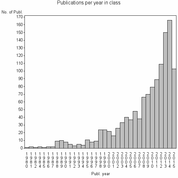
| 8054 | 1223 | 29.3 | 42% |
Classes in level above (level 2) |
| ID, lev. above |
Publications | Label for level above |
|---|---|---|
| 2075 | 4808 | PHOTOGRAMMETRIC RECORD//PHOTOGRAMMETRIC ENGINEERING AND REMOTE SENSING//ISPRS JOURNAL OF PHOTOGRAMMETRY AND REMOTE SENSING |
Terms with highest relevance score |
| Rank | Term | Type of term | Relevance score (tfidf) |
Class's shr. of term's tot. occurrences |
Shr. of publ. in class containing term |
Num. of publ. in class |
|---|---|---|---|---|---|---|
| 1 | BUILDING EXTRACTION | Author keyword | 21 | 38% | 4% | 45 |
| 2 | BUILDING DETECTION | Author keyword | 15 | 34% | 3% | 37 |
| 3 | ROAD NETWORK EXTRACTION | Author keyword | 14 | 65% | 1% | 13 |
| 4 | MOBILE LASER SCANNING | Author keyword | 10 | 41% | 2% | 19 |
| 5 | BUILDING RECONSTRUCTION | Author keyword | 10 | 34% | 2% | 24 |
| 6 | PROCEDURAL MODELING | Author keyword | 10 | 30% | 2% | 27 |
| 7 | ROAD EXTRACTION | Author keyword | 9 | 21% | 3% | 36 |
| 8 | MOBILE LASER SCANNING MLS | Author keyword | 7 | 53% | 1% | 10 |
| 9 | DENSE URBAN AREA | Author keyword | 6 | 80% | 0% | 4 |
| 10 | CHAIR REMOTE SENSING TECHNOL | Address | 6 | 58% | 1% | 7 |
Web of Science journal categories |
Author Key Words |
| Rank | Web of Science journal category | Relevance score (tfidf) |
Class's shr. of term's tot. occurrences |
Shr. of publ. in class containing term |
Num. of publ. in class |
LCSH search | Wikipedia search |
|---|---|---|---|---|---|---|---|
| 1 | BUILDING EXTRACTION | 21 | 38% | 4% | 45 | Search BUILDING+EXTRACTION | Search BUILDING+EXTRACTION |
| 2 | BUILDING DETECTION | 15 | 34% | 3% | 37 | Search BUILDING+DETECTION | Search BUILDING+DETECTION |
| 3 | ROAD NETWORK EXTRACTION | 14 | 65% | 1% | 13 | Search ROAD+NETWORK+EXTRACTION | Search ROAD+NETWORK+EXTRACTION |
| 4 | MOBILE LASER SCANNING | 10 | 41% | 2% | 19 | Search MOBILE+LASER+SCANNING | Search MOBILE+LASER+SCANNING |
| 5 | BUILDING RECONSTRUCTION | 10 | 34% | 2% | 24 | Search BUILDING+RECONSTRUCTION | Search BUILDING+RECONSTRUCTION |
| 6 | PROCEDURAL MODELING | 10 | 30% | 2% | 27 | Search PROCEDURAL+MODELING | Search PROCEDURAL+MODELING |
| 7 | ROAD EXTRACTION | 9 | 21% | 3% | 36 | Search ROAD+EXTRACTION | Search ROAD+EXTRACTION |
| 8 | MOBILE LASER SCANNING MLS | 7 | 53% | 1% | 10 | Search MOBILE+LASER+SCANNING+MLS | Search MOBILE+LASER+SCANNING+MLS |
| 9 | DENSE URBAN AREA | 6 | 80% | 0% | 4 | Search DENSE+URBAN+AREA | Search DENSE+URBAN+AREA |
| 10 | FACADE INTERPRETATION | 6 | 100% | 0% | 4 | Search FACADE+INTERPRETATION | Search FACADE+INTERPRETATION |
Key Words Plus |
| Rank | Web of Science journal category | Relevance score (tfidf) |
Class's shr. of term's tot. occurrences |
Shr. of publ. in class containing term |
Num. of publ. in class |
|---|---|---|---|---|---|
| 1 | AERIAL IMAGES | 44 | 44% | 6% | 76 |
| 2 | AERIAL IMAGERY | 25 | 47% | 3% | 40 |
| 3 | CENTERLINES | 21 | 85% | 1% | 11 |
| 4 | POINT CLOUDS | 18 | 29% | 4% | 53 |
| 5 | BUILDING RECONSTRUCTION | 13 | 69% | 1% | 11 |
| 6 | METER RESOLUTION | 12 | 75% | 1% | 9 |
| 7 | LASER SCANNING DATA | 11 | 26% | 3% | 37 |
| 8 | LIDAR POINT CLOUDS | 11 | 60% | 1% | 12 |
| 9 | MULTIPLE AERIAL IMAGES | 10 | 50% | 1% | 15 |
| 10 | OBJECT EXTRACTION | 10 | 47% | 1% | 16 |
Journals |
| Rank | Web of Science journal category | Relevance score (tfidf) |
Class's shr. of term's tot. occurrences |
Shr. of publ. in class containing term |
Num. of publ. in class |
|---|---|---|---|---|---|
| 1 | PHOTOGRAMMETRIE FERNERKUNDUNG GEOINFORMATION | 4 | 12% | 2% | 29 |
Reviews |
| Title | Publ. year | Cit. | Active references |
% act. ref. to same field |
|---|---|---|---|---|
| CityGML - Interoperable semantic 3D city models | 2012 | 23 | 26 | 65% |
| State of the art on automatic road extraction for GIS update: a novel classification | 2003 | 148 | 51 | 55% |
| Synthesis of Transportation Applications of Mobile LIDAR | 2013 | 9 | 28 | 57% |
| Multiplatform Mobile Laser Scanning: Usability and Performance | 2012 | 13 | 12 | 50% |
| Review of mobile mapping and surveying technologies | 2013 | 19 | 27 | 15% |
| Area-wide roof plane segmentation in airborne LiDAR point clouds | 2012 | 10 | 10 | 30% |
| Building Extraction from Airborne Laser Scanning Data: An Analysis of the State of the Art | 2015 | 0 | 50 | 74% |
| Positional Accuracy Analysis of Satellite Imagery by Circular Statistics | 2010 | 2 | 14 | 50% |
| Modelling and representation issues in automated feature extraction from aerial and satellite images | 2000 | 23 | 18 | 28% |
Address terms |
| Rank | Address term | Relevance score (tfidf) |
Class's shr. of term's tot. occurrences |
Shr. of publ. in class containing term |
Num. of publ. in class |
|---|---|---|---|---|---|
| 1 | CHAIR REMOTE SENSING TECHNOL | 6 | 58% | 0.6% | 7 |
| 2 | PHOTOGRAMMETRY GEOINFORMAT | 5 | 27% | 1.3% | 16 |
| 3 | FUJIAN SENSING COMP SMART CITIES | 4 | 67% | 0.3% | 4 |
| 4 | DIGITAL M PING | 4 | 75% | 0.2% | 3 |
| 5 | M PING SPACE | 4 | 50% | 0.5% | 6 |
| 6 | SRIG | 4 | 75% | 0.2% | 3 |
| 7 | COMP GR H IMMERS TECHNOL | 3 | 57% | 0.3% | 4 |
| 8 | URBAN MODELLING GRP | 3 | 43% | 0.5% | 6 |
| 9 | COMP GR H KNOWLEDGE VISUALIZAT CGV | 3 | 100% | 0.2% | 3 |
| 10 | FRENCH M PING AGCY | 3 | 100% | 0.2% | 3 |
Related classes at same level (level 1) |
| Rank | Relatedness score | Related classes |
|---|---|---|
| 1 | 0.0000187197 | TEMPORAL INDICES//INTERNATIONAL CHARTER//BUILDING DAMAGE ASSESSMENT |
| 2 | 0.0000111047 | PHOTOGRAMMETRIC RECORD//SATELLITE SURVEYING M PING PLICAT//SATELLITE SURVEYING M PING PLICAT SASMAC |
| 3 | 0.0000109952 | AIRBORNE LASER SCANNING//LIDAR//FOREST INVENTORY |
| 4 | 0.0000105223 | HYPERSPECTRAL IMAGE CLASSIFICATION//ACTIVE LEARNING AL//HYPERSPECTRAL IMAGE HSI CLASSIFICATION |
| 5 | 0.0000098193 | IMPERVIOUS SURFACE//CARTOG GIS GRP//IMPERVIOUS SURFACE ESTIMATION |
| 6 | 0.0000091077 | TRAFFIC SIGN RECOGNITION//ROAD SIGN RECOGNITION//TRAFFIC SIGN RECOGNITION TSR |
| 7 | 0.0000086993 | HIGH POLYTECH AVILA//LAND CARTOG ENGN//CLOSE RANGE REMOTE SENSING PHOTOGRAMMETRY GRP |
| 8 | 0.0000077394 | FUZZY LATTICE REASONING FLR//LATTICE COMPUTING//INTERVALS NUMBER IN |
| 9 | 0.0000072608 | VOLUNTEERED GEOGRAPHIC INFORMATION//CONFLATION//OPENSTREETMAP |
| 10 | 0.0000072518 | 3D OBJECT RETRIEVAL//3D MODEL RETRIEVAL//3D SHAPE RETRIEVAL |