Class information for: |
Basic class information |
| ID | Publications | Average number of references |
Avg. shr. active ref. in WoS |
|---|---|---|---|
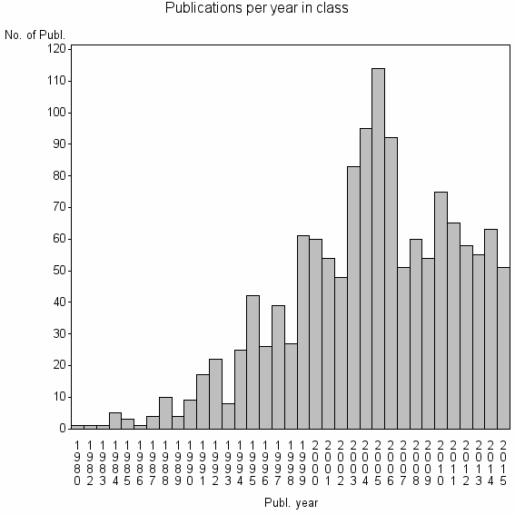
| 6666 | 1384 | 31.6 | 27% |
Classes in level above (level 2) |
| ID, lev. above |
Publications | Label for level above |
|---|---|---|
| 1769 | 5851 | INTERNATIONAL JOURNAL OF GEOGRAPHICAL INFORMATION SCIENCE//CARTOGRAPHIC JOURNAL//QUALITATIVE SPATIAL REASONING |
Terms with highest relevance score |
| Rank | Term | Type of term | Relevance score (tfidf) |
Class's shr. of term's tot. occurrences |
Shr. of publ. in class containing term |
Num. of publ. in class |
|---|---|---|---|---|---|---|
| 1 | QUALITATIVE SPATIAL REASONING | Author keyword | 68 | 57% | 6% | 80 |
| 2 | REGION CONNECTION CALCULUS | Author keyword | 44 | 77% | 2% | 30 |
| 3 | TOPOLOGICAL RELATIONS | Author keyword | 19 | 48% | 2% | 29 |
| 4 | INTERNATIONAL JOURNAL OF GEOGRAPHICAL INFORMATION SCIENCE | Journal | 14 | 10% | 9% | 130 |
| 5 | GEOG INFORMAT ANAL | Address | 13 | 27% | 3% | 42 |
| 6 | SPATIAL INFORMAT SCI ENGN | Address | 13 | 35% | 2% | 30 |
| 7 | MEREOTOPOLOGY | Author keyword | 13 | 49% | 1% | 19 |
| 8 | GEOINFORMATICA | Journal | 11 | 18% | 4% | 54 |
| 9 | GEOGRAPHIC INFORMATION RETRIEVAL | Author keyword | 10 | 38% | 2% | 22 |
| 10 | SPATIAL REASONING | Author keyword | 9 | 17% | 4% | 49 |
Web of Science journal categories |
Author Key Words |
| Rank | Web of Science journal category | Relevance score (tfidf) |
Class's shr. of term's tot. occurrences |
Shr. of publ. in class containing term |
Num. of publ. in class |
LCSH search | Wikipedia search |
|---|---|---|---|---|---|---|---|
| 1 | QUALITATIVE SPATIAL REASONING | 68 | 57% | 6% | 80 | Search QUALITATIVE+SPATIAL+REASONING | Search QUALITATIVE+SPATIAL+REASONING |
| 2 | REGION CONNECTION CALCULUS | 44 | 77% | 2% | 30 | Search REGION+CONNECTION+CALCULUS | Search REGION+CONNECTION+CALCULUS |
| 3 | TOPOLOGICAL RELATIONS | 19 | 48% | 2% | 29 | Search TOPOLOGICAL+RELATIONS | Search TOPOLOGICAL+RELATIONS |
| 4 | MEREOTOPOLOGY | 13 | 49% | 1% | 19 | Search MEREOTOPOLOGY | Search MEREOTOPOLOGY |
| 5 | GEOGRAPHIC INFORMATION RETRIEVAL | 10 | 38% | 2% | 22 | Search GEOGRAPHIC+INFORMATION+RETRIEVAL | Search GEOGRAPHIC+INFORMATION+RETRIEVAL |
| 6 | SPATIAL REASONING | 9 | 17% | 4% | 49 | Search SPATIAL+REASONING | Search SPATIAL+REASONING |
| 7 | TOPOLOGICAL PREDICATE | 9 | 83% | 0% | 5 | Search TOPOLOGICAL+PREDICATE | Search TOPOLOGICAL+PREDICATE |
| 8 | DIRECTION RELATIONS | 7 | 56% | 1% | 9 | Search DIRECTION+RELATIONS | Search DIRECTION+RELATIONS |
| 9 | CARDINAL DIRECTION RELATIONS | 7 | 67% | 0% | 6 | Search CARDINAL+DIRECTION+RELATIONS | Search CARDINAL+DIRECTION+RELATIONS |
| 10 | MEREOLOGY | 6 | 21% | 2% | 25 | Search MEREOLOGY | Search MEREOLOGY |
Key Words Plus |
| Rank | Web of Science journal category | Relevance score (tfidf) |
Class's shr. of term's tot. occurrences |
Shr. of publ. in class containing term |
Num. of publ. in class |
|---|---|---|---|---|---|
| 1 | REGION CONNECTION CALCULUS | 56 | 80% | 3% | 35 |
| 2 | COMPOSITION TABLE | 23 | 100% | 1% | 10 |
| 3 | MEREOTOPOLOGY | 21 | 65% | 1% | 20 |
| 4 | TOPOLOGICAL RELATIONS | 19 | 51% | 2% | 26 |
| 5 | CONTACT ALGEBRAS | 11 | 67% | 1% | 10 |
| 6 | PROXIMITY APPROACH | 8 | 70% | 1% | 7 |
| 7 | SPATIAL RELATIONS | 7 | 16% | 3% | 41 |
| 8 | TOPOLOGICAL SPATIAL RELATIONS | 7 | 67% | 0% | 6 |
| 9 | GAZETTEERS | 6 | 80% | 0% | 4 |
| 10 | LANGUAGE SPATIAL RELATIONS | 6 | 80% | 0% | 4 |
Journals |
| Rank | Web of Science journal category | Relevance score (tfidf) |
Class's shr. of term's tot. occurrences |
Shr. of publ. in class containing term |
Num. of publ. in class |
|---|---|---|---|---|---|
| 1 | INTERNATIONAL JOURNAL OF GEOGRAPHICAL INFORMATION SCIENCE | 14 | 10% | 9% | 130 |
| 2 | GEOINFORMATICA | 11 | 18% | 4% | 54 |
| 3 | SPATIAL COGNITION AND COMPUTATION | 5 | 22% | 2% | 22 |
| 4 | TRANSACTIONS IN GIS | 4 | 11% | 3% | 35 |
| 5 | INTERNATIONAL JOURNAL OF GEOGRAPHICAL INFORMATION SYSTEMS | 4 | 13% | 2% | 26 |
Reviews |
| Title | Publ. year | Cit. | Active references |
% act. ref. to same field |
|---|---|---|---|---|
| A survey of qualitative spatial representations | 2015 | 1 | 74 | 86% |
| Qualitative spatial representation and reasoning: An overview | 2001 | 196 | 46 | 76% |
| Ontological considerations in GIScience | 2005 | 68 | 41 | 49% |
| 3D geo-database research: Retrospective and future directions | 2011 | 13 | 20 | 30% |
| Literature review of spatio-temporal database models | 2004 | 35 | 12 | 50% |
| Spatial and temporal knowledge representation | 2009 | 7 | 32 | 72% |
| Geo-referencing with semi-automatic gazetteer expansion using lexico-syntactical patterns and co-reference analysis | 2011 | 1 | 6 | 83% |
| Progress in computational methods for representing geographical concepts | 1999 | 25 | 34 | 62% |
| Geodata as a systemic information resource | 2014 | 0 | 1 | 100% |
| A scale-explicit model for checking directional consistency in multi-resolution spatial data | 2010 | 1 | 15 | 80% |
Address terms |
| Rank | Address term | Relevance score (tfidf) |
Class's shr. of term's tot. occurrences |
Shr. of publ. in class containing term |
Num. of publ. in class |
|---|---|---|---|---|---|
| 1 | GEOG INFORMAT ANAL | 13 | 27% | 3.0% | 42 |
| 2 | SPATIAL INFORMAT SCI ENGN | 13 | 35% | 2.2% | 30 |
| 3 | AMSS UTS JOINT | 3 | 100% | 0.2% | 3 |
| 4 | NCGIA | 3 | 33% | 0.5% | 7 |
| 5 | SYMBOL COMP KNOWLEDGE ENGN | 3 | 42% | 0.4% | 5 |
| 6 | ADV SPATIAL INFORMAT TECHNOL | 2 | 22% | 0.7% | 9 |
| 7 | GEOVISTA | 2 | 16% | 0.9% | 13 |
| 8 | GIS TECHNOL SECT | 2 | 67% | 0.1% | 2 |
| 9 | LBS TEAM | 2 | 67% | 0.1% | 2 |
| 10 | REMOTE SENSING GEOG INFORMAT SYST | 2 | 12% | 1.2% | 16 |
Related classes at same level (level 1) |
| Rank | Relatedness score | Related classes |
|---|---|---|
| 1 | 0.0000179727 | TEMPORAL REASONING//TEMPORAL ABSTRACTION//TEMPORAL ABSTRACTIONS |
| 2 | 0.0000161658 | CARTOGRAPHIC GENERALIZATION//MAP GENERALISATION//MAP GENERALIZATION |
| 3 | 0.0000143869 | 2D C STRING//2D STRING//SIMILARITY RETRIEVAL |
| 4 | 0.0000100980 | VOLUNTEERED GEOGRAPHIC INFORMATION//CONFLATION//OPENSTREETMAP |
| 5 | 0.0000091768 | SPATIAL DATA TRANSFER STANDARD//SPATIAL QUERY PROCESSING AND DATA MINING//GTUB |
| 6 | 0.0000082290 | SPATIAL INFORMAT SCI SYST//JOINT INTELLIGENT SPATIAL COMP//SENSOR WEB |
| 7 | 0.0000080249 | HUMAN MOBILITY//SENSEABLE CITY//GEO TAGGED PHOTO |
| 8 | 0.0000067581 | FUZZY CONNECTEDNESS//GRAPH SEARCH ALGORITHMS//MIPG |
| 9 | 0.0000062752 | TEMPORAL DATABASES//TEMPORAL QUERY LANGUAGES//VALID TIME |
| 10 | 0.0000061841 | TRAPEZOIDATION//POLYGON OVERLAY//POINT CONTAINMENT |