Class information for: |
Basic class information |
| ID | Publications | Average number of references |
Avg. shr. active ref. in WoS |
|---|---|---|---|
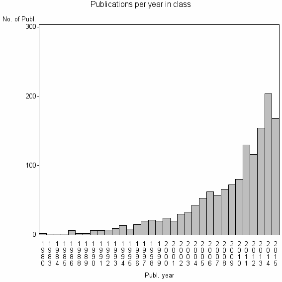
| 6199 | 1452 | 30.3 | 62% |
Classes in level above (level 2) |
| ID, lev. above |
Publications | Label for level above |
|---|---|---|
| 76 | 26792 | REMOTE SENSING//IMAGING SCIENCE & PHOTOGRAPHIC TECHNOLOGY//REMOTE SENSING OF ENVIRONMENT |
Terms with highest relevance score |
| Rank | Term | Type of term | Relevance score (tfidf) |
Class's shr. of term's tot. occurrences |
Shr. of publ. in class containing term |
Num. of publ. in class |
|---|---|---|---|---|---|---|
| 1 | REMOTE SENSING SIGNAL IMAGE PROC | Address | 87 | 73% | 5% | 67 |
| 2 | HYPERSPE AL COMP | Address | 44 | 63% | 3% | 45 |
| 3 | SPECTRAL UNMIXING | Author keyword | 35 | 27% | 7% | 108 |
| 4 | HYPERSPECTRAL UNMIXING | Author keyword | 33 | 51% | 3% | 47 |
| 5 | TECHNOL COMP COMMUN | Address | 33 | 43% | 4% | 58 |
| 6 | ENDMEMBER EXTRACTION | Author keyword | 29 | 39% | 4% | 59 |
| 7 | SUBPIXEL MAPPING SPM | Author keyword | 21 | 90% | 1% | 9 |
| 8 | SUPERRESOLUTION MAPPING | Author keyword | 21 | 90% | 1% | 9 |
| 9 | SPECTRAL MIXTURE ANALYSIS SMA | Author keyword | 19 | 80% | 1% | 12 |
| 10 | ORTHOGONAL SUBSPACE PROJECTION OSP | Author keyword | 18 | 56% | 2% | 22 |
Web of Science journal categories |
Author Key Words |
Key Words Plus |
| Rank | Web of Science journal category | Relevance score (tfidf) |
Class's shr. of term's tot. occurrences |
Shr. of publ. in class containing term |
Num. of publ. in class |
|---|---|---|---|---|---|
| 1 | ENDMEMBER EXTRACTION | 106 | 66% | 7% | 97 |
| 2 | HOPFIELD NEURAL NETWORK | 40 | 47% | 4% | 63 |
| 3 | SUBPIXEL SCALE | 33 | 100% | 1% | 13 |
| 4 | HYPERSPECTRAL IMAGERY | 33 | 24% | 8% | 119 |
| 5 | SUBSPACE PROJECTION APPROACH | 33 | 48% | 4% | 51 |
| 6 | SPECTRAL MIXTURE ANALYSIS | 28 | 22% | 8% | 114 |
| 7 | N FINDR | 26 | 67% | 2% | 24 |
| 8 | ENDMEMBER EXTRACTION ALGORITHMS | 26 | 69% | 2% | 22 |
| 9 | SENSING IMAGERY | 23 | 79% | 1% | 15 |
| 10 | SUB PIXEL SCALES | 20 | 100% | 1% | 9 |
Journals |
Reviews |
| Title | Publ. year | Cit. | Active references | % act. ref. to same field |
|---|---|---|---|---|
| Endmember variability in Spectral Mixture Analysis: A review | 2011 | 104 | 154 | 51% |
| Recent Developments in High Performance Computing for Remote Sensing: A Review | 2011 | 56 | 30 | 60% |
| Incorporating spatial information in spectral unmixing: A review | 2014 | 4 | 85 | 71% |
| Spectral unmixing | 2012 | 18 | 134 | 46% |
| Automated Hyperspectral Cueing for Civilian Search and Rescue | 2009 | 29 | 51 | 49% |
| A Review of Unsupervised Spectral Target Analysis for Hyperspectral Imagery | 2010 | 2 | 12 | 100% |
| Survey of hyperspectral image denoising methods based on tensor decompositions | 2013 | 2 | 27 | 48% |
| A Comparison of Multispectral ASTER and Hyperspectral AVIRIS Multiple Endmember Spectral Mixture Analysis for Sagebrush and Herbaceous Cover in Yellowstone | 2012 | 5 | 43 | 28% |
| INVERSION TECHNIQUES FOR PROPORTION ESTIMATION OF MIXELS IN HIGH-RESOLUTION SATELLITE IMAGE-ANALYSIS | 1993 | 0 | 2 | 100% |
| Imaging spectroscopy and the Airborne Visible Infrared Imaging Spectrometer (AVIRIS) | 1998 | 614 | 61 | 7% |
Address terms |
| Rank | Address term | Relevance score (tfidf) |
Class's shr. of term's tot. occurrences |
Shr. of publ. in class containing term |
Num. of publ. in class |
|---|---|---|---|---|---|
| 1 | REMOTE SENSING SIGNAL IMAGE PROC | 87 | 73% | 4.6% | 67 |
| 2 | HYPERSPE AL COMP | 44 | 63% | 3.1% | 45 |
| 3 | TECHNOL COMP COMMUN | 33 | 43% | 4.0% | 58 |
| 4 | HYPERSPE AL COMP HYPERCOMP | 12 | 86% | 0.4% | 6 |
| 5 | MONITORING ESTIMATE ENVIRONM DISASTER | 10 | 61% | 0.8% | 11 |
| 6 | IMINDS VISION | 6 | 80% | 0.3% | 4 |
| 7 | REMOTE SENSING EARTH OBSERVAT PROC T | 6 | 50% | 0.6% | 8 |
| 8 | DIPARTIMENTO ARMI NAVALI | 5 | 63% | 0.3% | 5 |
| 9 | INFORMAT ENGN SURVEYING M PING RE | 4 | 67% | 0.3% | 4 |
| 10 | QUANTITAT IMAGING MED | 4 | 67% | 0.3% | 4 |
Related classes at same level (level 1) |
| Rank | Relatedness score | Related classes |
|---|---|---|
| 1 | 0.0000219558 | IMPERVIOUS SURFACE//CARTOG GIS GRP//IMPERVIOUS SURFACE ESTIMATION |
| 2 | 0.0000193300 | ARTHUR BRANT EXPLORAT GEOPHYS//ASTER//LITHOLOGICAL MAPPING |
| 3 | 0.0000185036 | HYPERSPECTRAL IMAGE CLASSIFICATION//ACTIVE LEARNING AL//HYPERSPECTRAL IMAGE HSI CLASSIFICATION |
| 4 | 0.0000105624 | NON PHOTOSYNTHETIC VEGETATION//CROP RESIDUE COVER//CELLULOSE ABSORPTION INDEX CAI |
| 5 | 0.0000099637 | NONNEGATIVE MATRIX FACTORIZATION//NONNEGATIVE RANK//NON NEGATIVE MATRIX FACTORIZATION |
| 6 | 0.0000089642 | GLOBAL LAND COVER//SW GEOG SCI//RSU |
| 7 | 0.0000089448 | AIRBORNE PRISM EXPERIMENT APEX//ENVIRONMENTAL MAPPING AND ANALYSIS PROGRAM ENMAP//ESCOLA UNIV OPT OPTOMETRIA |
| 8 | 0.0000081689 | FRACTAL MEASUREMENT//OPTIMAL SPATIAL RESOLUTION//RESOLUTION TRANSFORMATION MODEL |
| 9 | 0.0000070746 | COLOR INFRARED PHOTOGRAPHY//INTEGRATED FARMING NAT OURCES//CONVENTIONAL COLOR VIDEO IMAGERY |
| 10 | 0.0000066994 | CHANGE DETECTION//LANDSAT//STARFM |