Class information for: |
Basic class information |
| ID | Publications | Average number of references |
Avg. shr. active ref. in WoS |
|---|---|---|---|
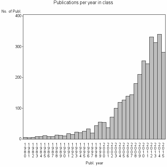
| 513 | 3296 | 39.4 | 45% |
Classes in level above (level 2) |
| ID, lev. above |
Publications | Label for level above |
|---|---|---|
| 1257 | 8427 | LANDSLIDES//LANDSLIDE//LANDSLIDE SUSCEPTIBILITY |
Terms with highest relevance score |
| Rank | Term | Type of term | Relevance score (tfidf) |
Class's shr. of term's tot. occurrences |
Shr. of publ. in class containing term |
Num. of publ. in class |
|---|---|---|---|---|---|---|
| 1 | LANDSLIDE SUSCEPTIBILITY | Author keyword | 321 | 84% | 5% | 178 |
| 2 | LANDSLIDE | Author keyword | 271 | 34% | 20% | 651 |
| 3 | LANDSLIDES | Journal | 192 | 51% | 8% | 271 |
| 4 | SHALLOW LANDSLIDES | Author keyword | 59 | 64% | 2% | 58 |
| 5 | GEOSCI INFORMAT | Address | 48 | 63% | 1% | 48 |
| 6 | LANDSLIDE SUSCEPTIBILITY MAP | Author keyword | 41 | 100% | 0% | 15 |
| 7 | LANDSLIDE SUSCEPTIBILITY MAPPING | Author keyword | 40 | 76% | 1% | 28 |
| 8 | ENGINEERING GEOLOGY | Journal | 37 | 11% | 10% | 323 |
| 9 | LANDSLIDE INVENTORY | Author keyword | 31 | 66% | 1% | 29 |
| 10 | LANDSLIDE DAM | Author keyword | 31 | 48% | 1% | 48 |
Web of Science journal categories |
Author Key Words |
| Rank | Web of Science journal category | Relevance score (tfidf) |
Class's shr. of term's tot. occurrences |
Shr. of publ. in class containing term |
Num. of publ. in class |
LCSH search | Wikipedia search |
|---|---|---|---|---|---|---|---|
| 1 | LANDSLIDE SUSCEPTIBILITY | 321 | 84% | 5% | 178 | Search LANDSLIDE+SUSCEPTIBILITY | Search LANDSLIDE+SUSCEPTIBILITY |
| 2 | LANDSLIDE | 271 | 34% | 20% | 651 | Search LANDSLIDE | Search LANDSLIDE |
| 3 | LANDSLIDES | 171 | 33% | 13% | 432 | Search LANDSLIDES | Search LANDSLIDES |
| 4 | SHALLOW LANDSLIDES | 59 | 64% | 2% | 58 | Search SHALLOW+LANDSLIDES | Search SHALLOW+LANDSLIDES |
| 5 | LANDSLIDE SUSCEPTIBILITY MAP | 41 | 100% | 0% | 15 | Search LANDSLIDE+SUSCEPTIBILITY+MAP | Search LANDSLIDE+SUSCEPTIBILITY+MAP |
| 6 | LANDSLIDE SUSCEPTIBILITY MAPPING | 40 | 76% | 1% | 28 | Search LANDSLIDE+SUSCEPTIBILITY+MAPPING | Search LANDSLIDE+SUSCEPTIBILITY+MAPPING |
| 7 | LANDSLIDE INVENTORY | 31 | 66% | 1% | 29 | Search LANDSLIDE+INVENTORY | Search LANDSLIDE+INVENTORY |
| 8 | LANDSLIDE DAM | 31 | 48% | 1% | 48 | Search LANDSLIDE+DAM | Search LANDSLIDE+DAM |
| 9 | SINMAP | 27 | 92% | 0% | 11 | Search SINMAP | Search SINMAP |
| 10 | LANDSLIDE HAZARD | 26 | 47% | 1% | 41 | Search LANDSLIDE+HAZARD | Search LANDSLIDE+HAZARD |
Key Words Plus |
| Rank | Web of Science journal category | Relevance score (tfidf) |
Class's shr. of term's tot. occurrences |
Shr. of publ. in class containing term |
Num. of publ. in class |
|---|---|---|---|---|---|
| 1 | SHALLOW LANDSLIDES | 209 | 76% | 4% | 145 |
| 2 | LANTAU ISLAND | 200 | 89% | 3% | 90 |
| 3 | FREQUENCY RATIO | 133 | 74% | 3% | 100 |
| 4 | DURATION CONTROL | 112 | 75% | 2% | 81 |
| 5 | HAZARD ZONATION | 104 | 90% | 1% | 45 |
| 6 | HAZARD | 92 | 19% | 13% | 433 |
| 7 | RAINFALL INDUCED LANDSLIDES | 88 | 76% | 2% | 61 |
| 8 | HAZARD EVALUATION | 86 | 68% | 2% | 76 |
| 9 | SUSCEPTIBILITY ASSESSMENT | 67 | 80% | 1% | 41 |
| 10 | DEBRIS FLOWS | 66 | 25% | 7% | 228 |
Journals |
| Rank | Web of Science journal category | Relevance score (tfidf) |
Class's shr. of term's tot. occurrences |
Shr. of publ. in class containing term |
Num. of publ. in class |
|---|---|---|---|---|---|
| 1 | LANDSLIDES | 192 | 51% | 8% | 271 |
| 2 | ENGINEERING GEOLOGY | 37 | 11% | 10% | 323 |
| 3 | JOURNAL OF MOUNTAIN SCIENCE | 8 | 11% | 2% | 70 |
| 4 | BULLETIN OF ENGINEERING GEOLOGY AND THE ENVIRONMENT | 8 | 11% | 2% | 68 |
Reviews |
| Title | Publ. year | Cit. | Active references | % act. ref. to same field |
|---|---|---|---|---|
| The Varnes classification of landslide types, an update | 2014 | 32 | 49 | 33% |
| Landslide hazard and risk zonation - why is it still so difficult? | 2006 | 188 | 51 | 80% |
| An assessment on the use of logistic regression and artificial neural networks with different sampling strategies for the preparation of landslide susceptibility maps | 2008 | 117 | 58 | 81% |
| Spatial data for landslide susceptibility, hazard, and vulnerability assessment: An overview | 2008 | 148 | 67 | 60% |
| Representative rainfall thresholds for landslides in the Nepal Himalaya | 2008 | 56 | 28 | 86% |
| Engineering geology maps: landslides and geographical information systems | 2006 | 83 | 217 | 68% |
| Transient deterministic shallow landslide modeling: Requirements for susceptibility and hazard assessments in a GIS framework | 2008 | 53 | 53 | 51% |
| A review of assessing landslide frequency for hazard zoning purposes | 2008 | 50 | 62 | 52% |
| Landslide hazard assessment: recent trends and techniques | 2013 | 2 | 73 | 95% |
| The third hans cloos lecture. Urban landslides: socioeconomic impacts and overview of mitigative strategies | 2007 | 20 | 4 | 75% |
Address terms |
| Rank | Address term | Relevance score (tfidf) |
Class's shr. of term's tot. occurrences |
Shr. of publ. in class containing term |
Num. of publ. in class |
|---|---|---|---|---|---|
| 1 | GEOSCI INFORMAT | 48 | 63% | 1.5% | 48 |
| 2 | IST RIC PROTEZ IDROGEOL | 17 | 44% | 0.9% | 30 |
| 3 | FO TRY GEO HYDROSCI | 17 | 70% | 0.4% | 14 |
| 4 | MT RISK ENGN UNIT | 17 | 100% | 0.2% | 8 |
| 5 | IRPI | 15 | 27% | 1.4% | 46 |
| 6 | LANDSLIDES | 12 | 44% | 0.6% | 20 |
| 7 | STATE GEOHAZARD PREVENT GEOENVIRONM PRO | 12 | 20% | 1.6% | 52 |
| 8 | STATE GEOHAZARDS PREVENT GEOENVIRONM PR | 10 | 63% | 0.3% | 10 |
| 9 | ACT TECTON VOLCANO | 9 | 27% | 0.8% | 28 |
| 10 | GEOL ENGN SURVEYING | 9 | 83% | 0.2% | 5 |
Related classes at same level (level 1) |
| Rank | Relatedness score | Related classes |
|---|---|---|
| 1 | 0.0000215398 | DEEP SEATED GRAVITATIONAL SLOPE DEFORMATION//SACKUNG//ROCK SLOPE FAILURE |
| 2 | 0.0000167611 | RESIDUAL FRICTION ANGLE//INTERIOR PLAINS//RING SHEAR TEST |
| 3 | 0.0000156897 | DEBRIS FLOW//LAHAR//RUNOUT DISTANCE |
| 4 | 0.0000144307 | ROCKFALL//ROCKFALL HAZARD//ROCK FALL |
| 5 | 0.0000114933 | SELF ORGANIZING OVERLAY NETWORK//ACTIVE POROSITY//BARRAGES AND RESERVOIRS |
| 6 | 0.0000114880 | SLOPE STABILITY//FACTOR OF SAFETY//CRITICAL SLIP SURFACE |
| 7 | 0.0000105206 | CONCRETE FACED ROCKFILL DAM//SEISMIC SLOPE STABILITY//PERMANENT DISPLACEMENT |
| 8 | 0.0000073948 | DENDROGEOMORPHOLOGY//DENDROGEOMORPHOL//DENDRO CH |
| 9 | 0.0000068578 | TEMPORAL INDICES//INTERNATIONAL CHARTER//BUILDING DAMAGE ASSESSMENT |
| 10 | 0.0000046990 | INFRASTRUCT ENGN TEAM//RELIABILITY BASED DESIGN//LOAD AND RESISTANCE FACTOR DESIGN |