Class information for: |
Basic class information |
| ID | Publications | Average number of references |
Avg. shr. active ref. in WoS |
|---|---|---|---|
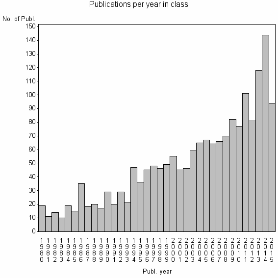
| 4050 | 1782 | 34.1 | 51% |
Classes in level above (level 2) |
| ID, lev. above |
Publications | Label for level above |
|---|---|---|
| 76 | 26792 | REMOTE SENSING//IMAGING SCIENCE & PHOTOGRAPHIC TECHNOLOGY//REMOTE SENSING OF ENVIRONMENT |
Terms with highest relevance score |
| Rank | Term | Type of term | Relevance score (tfidf) |
Class's shr. of term's tot. occurrences |
Shr. of publ. in class containing term |
Num. of publ. in class |
|---|---|---|---|---|---|---|
| 1 | GLOBAL LAND COVER | Author keyword | 32 | 88% | 1% | 15 |
| 2 | SW GEOG SCI | Address | 12 | 75% | 1% | 9 |
| 3 | RSU | Address | 8 | 70% | 0% | 7 |
| 4 | CROP AREA ESTIMATES | Author keyword | 8 | 100% | 0% | 5 |
| 5 | LAND SURFACE WATER INDEX | Author keyword | 8 | 100% | 0% | 5 |
| 6 | GLOBCOVER | Author keyword | 7 | 53% | 1% | 9 |
| 7 | USGS EROS DATA | Address | 7 | 67% | 0% | 6 |
| 8 | REGGIANI SPA | Address | 6 | 71% | 0% | 5 |
| 9 | GLC2000 | Author keyword | 6 | 58% | 0% | 7 |
| 10 | ACCURACY ASSESSMENT | Author keyword | 6 | 13% | 3% | 45 |
Web of Science journal categories |
Author Key Words |
| Rank | Web of Science journal category | Relevance score (tfidf) |
Class's shr. of term's tot. occurrences |
Shr. of publ. in class containing term |
Num. of publ. in class |
LCSH search | Wikipedia search |
|---|---|---|---|---|---|---|---|
| 1 | GLOBAL LAND COVER | 32 | 88% | 1% | 15 | Search GLOBAL+LAND+COVER | Search GLOBAL+LAND+COVER |
| 2 | CROP AREA ESTIMATES | 8 | 100% | 0% | 5 | Search CROP+AREA+ESTIMATES | Search CROP+AREA+ESTIMATES |
| 3 | LAND SURFACE WATER INDEX | 8 | 100% | 0% | 5 | Search LAND+SURFACE+WATER+INDEX | Search LAND+SURFACE+WATER+INDEX |
| 4 | GLOBCOVER | 7 | 53% | 1% | 9 | Search GLOBCOVER | Search GLOBCOVER |
| 5 | GLC2000 | 6 | 58% | 0% | 7 | Search GLC2000 | Search GLC2000 |
| 6 | ACCURACY ASSESSMENT | 6 | 13% | 3% | 45 | Search ACCURACY+ASSESSMENT | Search ACCURACY+ASSESSMENT |
| 7 | CROP ACREAGE | 5 | 60% | 0% | 6 | Search CROP+ACREAGE | Search CROP+ACREAGE |
| 8 | IRRIGATED AREAS | 5 | 50% | 0% | 7 | Search IRRIGATED+AREAS | Search IRRIGATED+AREAS |
| 9 | CROPLAND MAPPING | 4 | 75% | 0% | 3 | Search CROPLAND+MAPPING | Search CROPLAND+MAPPING |
| 10 | PRODUCERS ACCURACY | 4 | 75% | 0% | 3 | Search PRODUCERS+ACCURACY | Search PRODUCERS+ACCURACY |
Key Words Plus |
| Rank | Web of Science journal category | Relevance score (tfidf) |
Class's shr. of term's tot. occurrences |
Shr. of publ. in class containing term |
Num. of publ. in class |
|---|---|---|---|---|---|
| 1 | ACCURACY ASSESSMENT | 41 | 24% | 8% | 151 |
| 2 | IGBP DISCOVER | 40 | 66% | 2% | 38 |
| 3 | REMOTELY SENSED DATA | 27 | 15% | 10% | 170 |
| 4 | GLC2000 | 24 | 91% | 1% | 10 |
| 5 | THEMATIC MAP ACCURACY | 21 | 64% | 1% | 21 |
| 6 | VALIDATION DATA SET | 21 | 90% | 1% | 9 |
| 7 | USE LAND COVER LULC | 21 | 85% | 1% | 11 |
| 8 | THEMATIC MAPS | 18 | 53% | 1% | 24 |
| 9 | MAP ACCURACY | 16 | 52% | 1% | 22 |
| 10 | AREA ESTIMATION | 16 | 58% | 1% | 18 |
Journals |
Reviews |
| Title | Publ. year | Cit. | Active references | % act. ref. to same field |
|---|---|---|---|---|
| Good practices for estimating area and assessing accuracy of land change | 2014 | 27 | 68 | 60% |
| Status of land cover classification accuracy assessment | 2002 | 1093 | 121 | 71% |
| A REVIEW OF ASSESSING THE ACCURACY OF CLASSIFICATIONS OF REMOTELY SENSED DATA | 1991 | 2174 | 14 | 86% |
| Challenges in using land use and land cover data for global change studies | 2011 | 71 | 93 | 26% |
| ACCURACY ASSESSMENT OF SATELLITE-DERIVED LAND-COVER DATA - A REVIEW | 1994 | 153 | 20 | 90% |
| Remote sensing and land cover area estimation | 2004 | 95 | 80 | 58% |
| Land cover mapping of large areas from satellites: status and research priorities | 2000 | 223 | 83 | 47% |
| Modeling the Probability of Misclassification in a Map of Land Cover Change | 2011 | 4 | 19 | 79% |
| Remote sensing imagery in vegetation mapping: a review | 2008 | 156 | 82 | 21% |
| Meta-discoveries from a synthesis of satellite-based land-cover mapping research | 2014 | 1 | 28 | 57% |
Address terms |
| Rank | Address term | Relevance score (tfidf) |
Class's shr. of term's tot. occurrences |
Shr. of publ. in class containing term |
Num. of publ. in class |
|---|---|---|---|---|---|
| 1 | SW GEOG SCI | 12 | 75% | 0.5% | 9 |
| 2 | RSU | 8 | 70% | 0.4% | 7 |
| 3 | USGS EROS DATA | 7 | 67% | 0.3% | 6 |
| 4 | REGGIANI SPA | 6 | 71% | 0.3% | 5 |
| 5 | EROS DATA | 6 | 19% | 1.5% | 27 |
| 6 | EXPERTISE TELEDETECTIE T | 3 | 100% | 0.2% | 3 |
| 7 | GEOG ANAL MONITORING PROGRAM | 3 | 100% | 0.2% | 3 |
| 8 | CEGI | 3 | 50% | 0.2% | 4 |
| 9 | GVM UNIT | 3 | 60% | 0.2% | 3 |
| 10 | EXPOSURE E243 05 | 2 | 67% | 0.1% | 2 |
Related classes at same level (level 1) |
| Rank | Relatedness score | Related classes |
|---|---|---|
| 1 | 0.0000244602 | CHANGE DETECTION//LANDSAT//STARFM |
| 2 | 0.0000196565 | CROP YIELD FORECASTING//WEATHER YIELD MODEL//MONITORING TIME |
| 3 | 0.0000190518 | HYPERSPECTRAL IMAGE CLASSIFICATION//ACTIVE LEARNING AL//HYPERSPECTRAL IMAGE HSI CLASSIFICATION |
| 4 | 0.0000171064 | IMPERVIOUS SURFACE//CARTOG GIS GRP//IMPERVIOUS SURFACE ESTIMATION |
| 5 | 0.0000170041 | SPECTRAL VARIATION HYPOTHESIS//DYNAMIC HABITAT INDEX//BIOLOGICAL RICHNESS |
| 6 | 0.0000135280 | TOPOGRAPHIC CORRECTION//MINNAERT//ADJACENCY EFFECT |
| 7 | 0.0000133182 | HISTORICAL IMAGERY//AERIAL INFRARED THERMOGRAPHY//CONSERVATION ASSESSMENT AND PLANNING |
| 8 | 0.0000126418 | 3D GEOLOGIC MODEL//CAREX PSEUDOCURAICA//DISASTER PREVENT FLUVIAL MARINE DISAST |
| 9 | 0.0000117628 | FRACTAL MEASUREMENT//OPTIMAL SPATIAL RESOLUTION//RESOLUTION TRANSFORMATION MODEL |
| 10 | 0.0000108673 | PHENOLOGY//NDVI//LEAF UNFOLDING |