Class information for: |
Basic class information |
| ID | Publications | Average number of references |
Avg. shr. active ref. in WoS |
|---|---|---|---|
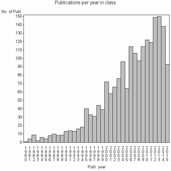
| 3230 | 1956 | 27.4 | 46% |
Classes in level above (level 2) |
| ID, lev. above |
Publications | Label for level above |
|---|---|---|
| 2656 | 2963 | GROUND PENETRATING RADAR//GROUND PENETRATING RADAR GPR//GPR |
Terms with highest relevance score |
| Rank | Term | Type of term | Relevance score (tfidf) |
Class's shr. of term's tot. occurrences |
Shr. of publ. in class containing term |
Num. of publ. in class |
|---|---|---|---|---|---|---|
| 1 | GROUND PENETRATING RADAR | Author keyword | 140 | 27% | 23% | 448 |
| 2 | GPR | Author keyword | 64 | 24% | 12% | 232 |
| 3 | GROUND PENETRATING RADAR GPR | Author keyword | 61 | 35% | 7% | 144 |
| 4 | JOURNAL OF APPLIED GEOPHYSICS | Journal | 34 | 13% | 12% | 241 |
| 5 | NEAR SURFACE GEOPHYSICS | Journal | 26 | 21% | 6% | 111 |
| 6 | BOREHOLE RADAR | Author keyword | 14 | 36% | 2% | 31 |
| 7 | RADAR STRATIGRAPHY | Author keyword | 9 | 83% | 0% | 5 |
| 8 | ROOT DETECTION | Author keyword | 8 | 70% | 0% | 7 |
| 9 | ARCHAEOLOGICAL PROSPECTION | Journal | 8 | 18% | 2% | 42 |
| 10 | GEORADAR | Author keyword | 8 | 37% | 1% | 17 |
Web of Science journal categories |
Author Key Words |
| Rank | Web of Science journal category | Relevance score (tfidf) |
Class's shr. of term's tot. occurrences |
Shr. of publ. in class containing term |
Num. of publ. in class |
LCSH search | Wikipedia search |
|---|---|---|---|---|---|---|---|
| 1 | GROUND PENETRATING RADAR | 140 | 27% | 23% | 448 | Search GROUND+PENETRATING+RADAR | Search GROUND+PENETRATING+RADAR |
| 2 | GPR | 64 | 24% | 12% | 232 | Search GPR | Search GPR |
| 3 | GROUND PENETRATING RADAR GPR | 61 | 35% | 7% | 144 | Search GROUND+PENETRATING+RADAR+GPR | Search GROUND+PENETRATING+RADAR+GPR |
| 4 | BOREHOLE RADAR | 14 | 36% | 2% | 31 | Search BOREHOLE+RADAR | Search BOREHOLE+RADAR |
| 5 | RADAR STRATIGRAPHY | 9 | 83% | 0% | 5 | Search RADAR+STRATIGRAPHY | Search RADAR+STRATIGRAPHY |
| 6 | ROOT DETECTION | 8 | 70% | 0% | 7 | Search ROOT+DETECTION | Search ROOT+DETECTION |
| 7 | GEORADAR | 8 | 37% | 1% | 17 | Search GEORADAR | Search GEORADAR |
| 8 | ARCHAEOLOGICAL INVESTIGATIONS | 6 | 71% | 0% | 5 | Search ARCHAEOLOGICAL+INVESTIGATIONS | Search ARCHAEOLOGICAL+INVESTIGATIONS |
| 9 | CROSSHOLE RADAR | 6 | 71% | 0% | 5 | Search CROSSHOLE+RADAR | Search CROSSHOLE+RADAR |
| 10 | DIRECTIONAL BOREHOLE RADAR | 6 | 47% | 0% | 9 | Search DIRECTIONAL+BOREHOLE+RADAR | Search DIRECTIONAL+BOREHOLE+RADAR |
Key Words Plus |
| Rank | Web of Science journal category | Relevance score (tfidf) |
Class's shr. of term's tot. occurrences |
Shr. of publ. in class containing term |
Num. of publ. in class |
|---|---|---|---|---|---|
| 1 | GROUND PENETRATING RADAR | 202 | 31% | 27% | 534 |
| 2 | GPR | 107 | 49% | 8% | 159 |
| 3 | GPR DATA | 75 | 71% | 3% | 61 |
| 4 | GEORADAR DATA | 55 | 87% | 1% | 27 |
| 5 | 3 DIMENSIONAL GEORADAR | 32 | 80% | 1% | 20 |
| 6 | BOREHOLE RADAR | 32 | 52% | 2% | 44 |
| 7 | GEORADAR | 23 | 72% | 1% | 18 |
| 8 | 3 D FLUID PERMEABILITY | 20 | 100% | 0% | 9 |
| 9 | MULTI OFFSET | 15 | 73% | 1% | 11 |
| 10 | PENETRATING RADAR | 14 | 31% | 2% | 37 |
Journals |
| Rank | Web of Science journal category | Relevance score (tfidf) |
Class's shr. of term's tot. occurrences |
Shr. of publ. in class containing term |
Num. of publ. in class |
|---|---|---|---|---|---|
| 1 | JOURNAL OF APPLIED GEOPHYSICS | 34 | 13% | 12% | 241 |
| 2 | NEAR SURFACE GEOPHYSICS | 26 | 21% | 6% | 111 |
| 3 | ARCHAEOLOGICAL PROSPECTION | 8 | 18% | 2% | 42 |
| 4 | JOURNAL OF ENVIRONMENTAL AND ENGINEERING GEOPHYSICS | 4 | 12% | 2% | 31 |
Reviews |
| Title | Publ. year | Cit. | Active references | % act. ref. to same field |
|---|---|---|---|---|
| Ground-penetrating radar and its use in sedimentology: principles, problems and progress | 2004 | 280 | 164 | 69% |
| Measuring Soil Water Content with Ground Penetrating Radar: A Review | 2003 | 285 | 54 | 52% |
| Application of ground penetrating radar for coarse root detection and quantification: a review | 2013 | 9 | 30 | 50% |
| GPR survey at Lapa do Santo archaeological site, Lagoa Santa karstic region, Minas Gerais state, Brazil | 2010 | 9 | 16 | 56% |
| Ground penetrating radar for environmental applications | 2001 | 57 | 37 | 57% |
| GPR and inductive electromagnetic surveys applied in three coastal sambaqui (shell mounds) archaeological sites in Santa Catarina state, South Brazil | 2009 | 10 | 11 | 55% |
| Radio wave techniques for non-destructive archaeological investigations | 2011 | 6 | 12 | 33% |
| A Review of the Use of Geophysical Archaeological Prospection in Sweden | 2011 | 3 | 5 | 40% |
| Nondestructive testing of asphalt pavements for structural condition evaluation: a state of the art | 2008 | 9 | 36 | 25% |
| Radarfacies and sedimentological analysis: Study of sedimentary substrate from an archaeological site (shell mound), southern Brazil | 2015 | 0 | 23 | 26% |
Address terms |
| Rank | Address term | Relevance score (tfidf) |
Class's shr. of term's tot. occurrences |
Shr. of publ. in class containing term |
Num. of publ. in class |
|---|---|---|---|---|---|
| 1 | EARTH SCI PLICAT YEBIM | 6 | 80% | 0.2% | 4 |
| 2 | NE ASIAN STUDIES | 6 | 20% | 1.5% | 29 |
| 3 | GEOPHYS INVEST SHALLOW SUBSUR E | 6 | 24% | 1.1% | 22 |
| 4 | PROCHE SUR E | 3 | 57% | 0.2% | 4 |
| 5 | PL ENVIRONM GEOPHYS GRP | 3 | 24% | 0.6% | 11 |
| 6 | ASTRON GEOFIS CIENCIAS ATMOSFER IAG | 3 | 38% | 0.3% | 6 |
| 7 | EUETIB CEIB | 3 | 50% | 0.2% | 4 |
| 8 | 8 2 | 3 | 42% | 0.3% | 5 |
| 9 | AGROSPHERE ICG4 | 2 | 44% | 0.2% | 4 |
| 10 | ARCHAEOL MONUMENTAL HERITAGE IBAM | 2 | 67% | 0.1% | 2 |
Related classes at same level (level 1) |
| Rank | Relatedness score | Related classes |
|---|---|---|
| 1 | 0.0000160025 | ELECTROMAGNETIC INDUCTION EMI//UNEXPLODED ORDNANCE UXO//UNEXPLODED ORDNANCE |
| 2 | 0.0000117150 | ELECTRICAL RESISTIVITY TOMOGRAPHY//JOURNAL OF APPLIED GEOPHYSICS//ELECTRICAL RESISTIVITY IMAGING |
| 3 | 0.0000111019 | TIME DOMAIN REFLECTOMETRY//TDR//TIME DOMAIN REFLECTOMETRY TDR |
| 4 | 0.0000081926 | FORENSIC GEOSCIENCE//FORENSIC PALYNOLOGY//FORENSIC GEOPHYSICS |
| 5 | 0.0000081329 | APPARENT ELECTRICAL CONDUCTIVITY//GRP SOIL SPATIAL INVENTORY TECH//EM38 |
| 6 | 0.0000063174 | MICROWAVE IMAGING//ELECTROMAGNETIC SCATTERING INVERSE PROBLEMS//INVERSE SCATTERING |
| 7 | 0.0000061258 | CONTROLLED SOURCE SEISMOL GRP//CROOKED LINE//SEZ GEOL PLICATA GEOFIS PLICATA |
| 8 | 0.0000060555 | COMP GEOPHYS//TRAVELTIME//TRAVELTIME COMPUTATION |
| 9 | 0.0000059708 | INDUCED POLARIZATION//COMPLEX RESISTIVITY//SPECTRAL INDUCED POLARIZATION |
| 10 | 0.0000057194 | RADAR IMAGING//THROUGH WALL IMAGING TWI//ULTRAWIDEBAND UWB RADAR |