Class information for: |
Basic class information |
| ID | Publications | Average number of references |
Avg. shr. active ref. in WoS |
|---|---|---|---|
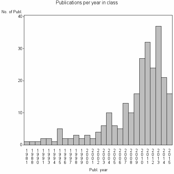
| 24698 | 254 | 25.9 | 38% |
Classes in level above (level 2) |
| ID, lev. above |
Publications | Label for level above |
|---|---|---|
| 2075 | 4808 | PHOTOGRAMMETRIC RECORD//PHOTOGRAMMETRIC ENGINEERING AND REMOTE SENSING//ISPRS JOURNAL OF PHOTOGRAMMETRY AND REMOTE SENSING |
Terms with highest relevance score |
| Rank | Term | Type of term | Relevance score (tfidf) |
Class's shr. of term's tot. occurrences |
Shr. of publ. in class containing term |
Num. of publ. in class |
|---|---|---|---|---|---|---|
| 1 | TEMPORAL INDICES | Author keyword | 2 | 67% | 1% | 2 |
| 2 | INTERNATIONAL CHARTER | Author keyword | 2 | 50% | 1% | 3 |
| 3 | BUILDING DAMAGE ASSESSMENT | Author keyword | 1 | 38% | 1% | 3 |
| 4 | BUILDING COLLAPSE DETECTION | Author keyword | 1 | 100% | 1% | 2 |
| 5 | BUILT UP DAMAGE BD | Author keyword | 1 | 100% | 1% | 2 |
| 6 | NOISE CLUSTER NC | Author keyword | 1 | 100% | 1% | 2 |
| 7 | SUPPORT EXTERNAL SECUR UNIT | Address | 1 | 50% | 1% | 2 |
| 8 | ENHANCED FUJITA SCALE | Author keyword | 1 | 40% | 1% | 2 |
| 9 | NATURAL DISASTER MONITORING | Author keyword | 1 | 40% | 1% | 2 |
| 10 | RAPID MAPPING | Author keyword | 1 | 16% | 2% | 5 |
Web of Science journal categories |
Author Key Words |
| Rank | Web of Science journal category | Relevance score (tfidf) |
Class's shr. of term's tot. occurrences |
Shr. of publ. in class containing term |
Num. of publ. in class |
LCSH search | Wikipedia search |
|---|---|---|---|---|---|---|---|
| 1 | TEMPORAL INDICES | 2 | 67% | 1% | 2 | Search TEMPORAL+INDICES | Search TEMPORAL+INDICES |
| 2 | INTERNATIONAL CHARTER | 2 | 50% | 1% | 3 | Search INTERNATIONAL+CHARTER | Search INTERNATIONAL+CHARTER |
| 3 | BUILDING DAMAGE ASSESSMENT | 1 | 38% | 1% | 3 | Search BUILDING+DAMAGE+ASSESSMENT | Search BUILDING+DAMAGE+ASSESSMENT |
| 4 | BUILDING COLLAPSE DETECTION | 1 | 100% | 1% | 2 | Search BUILDING+COLLAPSE+DETECTION | Search BUILDING+COLLAPSE+DETECTION |
| 5 | BUILT UP DAMAGE BD | 1 | 100% | 1% | 2 | Search BUILT+UP+DAMAGE+BD | Search BUILT+UP+DAMAGE+BD |
| 6 | NOISE CLUSTER NC | 1 | 100% | 1% | 2 | Search NOISE+CLUSTER+NC | Search NOISE+CLUSTER+NC |
| 7 | ENHANCED FUJITA SCALE | 1 | 40% | 1% | 2 | Search ENHANCED+FUJITA+SCALE | Search ENHANCED+FUJITA+SCALE |
| 8 | NATURAL DISASTER MONITORING | 1 | 40% | 1% | 2 | Search NATURAL+DISASTER+MONITORING | Search NATURAL+DISASTER+MONITORING |
| 9 | RAPID MAPPING | 1 | 16% | 2% | 5 | Search RAPID+MAPPING | Search RAPID+MAPPING |
| 10 | SENTINEL ASIA | 1 | 33% | 1% | 2 | Search SENTINEL+ASIA | Search SENTINEL+ASIA |
Key Words Plus |
| Rank | Web of Science journal category | Relevance score (tfidf) |
Class's shr. of term's tot. occurrences |
Shr. of publ. in class containing term |
Num. of publ. in class |
|---|---|---|---|---|---|
| 1 | INTERNATIONAL CHARTER | 4 | 75% | 1% | 3 |
| 2 | MAJOR DISASTERS | 3 | 50% | 2% | 4 |
| 3 | COLLAPSED BUILDINGS | 3 | 60% | 1% | 3 |
| 4 | BUILDING DAMAGE DETECTION | 2 | 67% | 1% | 2 |
| 5 | KUTCH EARTHQUAKE | 2 | 67% | 1% | 2 |
| 6 | HIGH RESOLUTION SATELLITE | 2 | 33% | 2% | 4 |
| 7 | MULTITEMPORAL SAR | 1 | 25% | 2% | 4 |
| 8 | 2010 HAITI EARTHQUAKE | 1 | 20% | 2% | 4 |
| 9 | HAITI EARTHQUAKE | 1 | 20% | 2% | 4 |
| 10 | 2011 TOHOKU | 1 | 50% | 0% | 1 |
Journals |
Reviews |
| Title | Publ. year | Cit. | Active references | % act. ref. to same field |
|---|---|---|---|---|
| A comprehensive review of earthquake-induced building damage detection with remote sensing techniques | 2013 | 16 | 54 | 78% |
| Sentinel Asia: A space-based disaster management support system in the Asia-Pacific region | 2013 | 1 | 2 | 100% |
| Space-based response to the 2011 Great East Japan Earthquake: Lessons learnt from JAXA's support using earth observation satellites | 2015 | 0 | 3 | 100% |
| Remote sensing contributing to assess earthquake risk: from a literature review towards a roadmap | 2013 | 6 | 166 | 20% |
| Geo-spatial information and technologies in support of EU crisis management | 2010 | 5 | 10 | 50% |
| A review of the status of satellite remote sensing and image processing techniques for mapping natural hazards and disasters | 2009 | 41 | 84 | 8% |
| An Analysis of Geospatial Technologies for Risk and Natural Disaster Management | 2012 | 5 | 29 | 14% |
Address terms |
| Rank | Address term | Relevance score (tfidf) |
Class's shr. of term's tot. occurrences |
Shr. of publ. in class containing term |
Num. of publ. in class |
|---|---|---|---|---|---|
| 1 | SUPPORT EXTERNAL SECUR UNIT | 1 | 50% | 0.8% | 2 |
| 2 | BERT S TURNER CONSTRUCT MANAGEMENT | 1 | 50% | 0.4% | 1 |
| 3 | EARTH SYST ANAL ESA | 1 | 50% | 0.4% | 1 |
| 4 | GFDRR | 1 | 50% | 0.4% | 1 |
| 5 | GLOBAL IL DISASTER REDUCT RECOVERY | 1 | 50% | 0.4% | 1 |
| 6 | HAKKA LANGUAGE SOCIAL SCI | 1 | 50% | 0.4% | 1 |
| 7 | HAKKA POLIT ECON | 1 | 50% | 0.4% | 1 |
| 8 | MIN ENGN GEODET GEOG INFORMAT TECHNOL | 1 | 50% | 0.4% | 1 |
| 9 | MODEM ENGN SURVEYING | 1 | 50% | 0.4% | 1 |
| 10 | NAT PL SCI GEODET GEOG INFORMAT TE | 1 | 50% | 0.4% | 1 |
Related classes at same level (level 1) |
| Rank | Relatedness score | Related classes |
|---|---|---|
| 1 | 0.0000187197 | BUILDING EXTRACTION//BUILDING DETECTION//ROAD NETWORK EXTRACTION |
| 2 | 0.0000135665 | CHANGE DETECTION//LANDSAT//STARFM |
| 3 | 0.0000096789 | SPACE POLICY//CHINA MIDDLE EAST//EOS DATA |
| 4 | 0.0000093132 | INTERFEROMETRIC SYNTHETIC APERTURE RADAR INSAR//SYNTHETIC APERTURE RADAR INTERFEROMETRY INSAR//INSAR |
| 5 | 0.0000092913 | HYPERSPECTRAL IMAGE CLASSIFICATION//ACTIVE LEARNING AL//HYPERSPECTRAL IMAGE HSI CLASSIFICATION |
| 6 | 0.0000089601 | PHOTOGRAMMETRIC RECORD//SATELLITE SURVEYING M PING PLICAT//SATELLITE SURVEYING M PING PLICAT SASMAC |
| 7 | 0.0000084961 | EARTH PLANETARY REMOTE SENSING//RADAR ALTIMETRY//SPACE INFORMAT TECHNOL SYST |
| 8 | 0.0000079352 | BASE CASE SCENARIO//CONTRACTS AND WARRANTIES//INDUSTRIES PHARMACEUTICALS |
| 9 | 0.0000076626 | VOLUNTEERED GEOGRAPHIC INFORMATION//CONFLATION//OPENSTREETMAP |
| 10 | 0.0000068578 | LANDSLIDE SUSCEPTIBILITY//LANDSLIDE//LANDSLIDES |