Class information for: |
Basic class information |
| ID | Publications | Average number of references |
Avg. shr. active ref. in WoS |
|---|---|---|---|
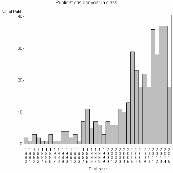
| 20736 | 387 | 37.0 | 28% |
Classes in level above (level 2) |
| ID, lev. above |
Publications | Label for level above |
|---|---|---|
| 208 | 20278 | ARCHAEOLOGY//AMERICAN ANTIQUITY//ANTHROPOLOGY |
Terms with highest relevance score |
| Rank | Term | Type of term | Relevance score (tfidf) |
Class's shr. of term's tot. occurrences |
Shr. of publ. in class containing term |
Num. of publ. in class |
|---|---|---|---|---|---|---|
| 1 | CROP MARKS | Author keyword | 11 | 69% | 2% | 9 |
| 2 | ARCHAEOLOGICAL PROSPECTION | Journal | 10 | 20% | 12% | 47 |
| 3 | REMOTE SENSING ARCHAEOLOGY | Author keyword | 6 | 53% | 2% | 8 |
| 4 | ARCHAEOL ARCHITECTURAL HERITAGE | Address | 4 | 75% | 1% | 3 |
| 5 | BIRMINGHAM ARCHAEOL | Address | 4 | 75% | 1% | 3 |
| 6 | HP VISUAL SPATIAL TECHNOL | Address | 4 | 75% | 1% | 3 |
| 7 | SATELLITE SURVEY | Author keyword | 4 | 75% | 1% | 3 |
| 8 | HOLLOW WAYS | Author keyword | 3 | 100% | 1% | 3 |
| 9 | ARCHAEO GEOPHYSICS | Author keyword | 2 | 67% | 1% | 2 |
| 10 | ARCHAEOLOGICAL INDEX | Author keyword | 2 | 67% | 1% | 2 |
Web of Science journal categories |
Author Key Words |
| Rank | Web of Science journal category | Relevance score (tfidf) |
Class's shr. of term's tot. occurrences |
Shr. of publ. in class containing term |
Num. of publ. in class |
LCSH search | Wikipedia search |
|---|---|---|---|---|---|---|---|
| 1 | CROP MARKS | 11 | 69% | 2% | 9 | Search CROP+MARKS | Search CROP+MARKS |
| 2 | REMOTE SENSING ARCHAEOLOGY | 6 | 53% | 2% | 8 | Search REMOTE+SENSING+ARCHAEOLOGY | Search REMOTE+SENSING+ARCHAEOLOGY |
| 3 | ARCHAEOLOGICAL PROSPECTION | 6 | 35% | 4% | 14 | Search ARCHAEOLOGICAL+PROSPECTION | Search ARCHAEOLOGICAL+PROSPECTION |
| 4 | SATELLITE SURVEY | 4 | 75% | 1% | 3 | Search SATELLITE+SURVEY | Search SATELLITE+SURVEY |
| 5 | HOLLOW WAYS | 3 | 100% | 1% | 3 | Search HOLLOW+WAYS | Search HOLLOW+WAYS |
| 6 | ARCHAEO GEOPHYSICS | 2 | 67% | 1% | 2 | Search ARCHAEO+GEOPHYSICS | Search ARCHAEO+GEOPHYSICS |
| 7 | ARCHAEOLOGICAL INDEX | 2 | 67% | 1% | 2 | Search ARCHAEOLOGICAL+INDEX | Search ARCHAEOLOGICAL+INDEX |
| 8 | CULTURAL REMAINS | 2 | 67% | 1% | 2 | Search CULTURAL+REMAINS | Search CULTURAL+REMAINS |
| 9 | AERIAL ARCHAEOLOGY | 2 | 25% | 2% | 6 | Search AERIAL+ARCHAEOLOGY | Search AERIAL+ARCHAEOLOGY |
| 10 | AERIAL PROSPECTION | 1 | 100% | 1% | 2 | Search AERIAL+PROSPECTION | Search AERIAL+PROSPECTION |
Key Words Plus |
| Rank | Web of Science journal category | Relevance score (tfidf) |
Class's shr. of term's tot. occurrences |
Shr. of publ. in class containing term |
Num. of publ. in class |
|---|---|---|---|---|---|
| 1 | RELIEF MODELS | 35 | 89% | 4% | 16 |
| 2 | PROSPECTION | 15 | 42% | 7% | 28 |
| 3 | CORONA SATELLITE PHOTOGRAPHY | 11 | 78% | 2% | 7 |
| 4 | CROP MARKS | 9 | 67% | 2% | 8 |
| 5 | ARCHAEOLOGICAL PROSPECTION | 8 | 70% | 2% | 7 |
| 6 | SATELLITE PHOTOGRAPHY | 4 | 67% | 1% | 4 |
| 7 | ARCHAEOLOGICAL FEATURES | 3 | 50% | 1% | 4 |
| 8 | ARCHAEOLOGICAL CROP MARKS | 2 | 67% | 1% | 2 |
| 9 | MAYA LANDSCAPE | 2 | 67% | 1% | 2 |
| 10 | CARACOL | 1 | 100% | 1% | 2 |
Journals |
| Rank | Web of Science journal category | Relevance score (tfidf) |
Class's shr. of term's tot. occurrences |
Shr. of publ. in class containing term |
Num. of publ. in class |
|---|---|---|---|---|---|
| 1 | ARCHAEOLOGICAL PROSPECTION | 10 | 20% | 12% | 47 |
Reviews |
| Title | Publ. year | Cit. | Active references | % act. ref. to same field |
|---|---|---|---|---|
| Light detection and ranging (lidar) in the Witham Valley, Lincolnshire: an assessment of new remote sensing techniques | 2006 | 14 | 3 | 100% |
| A repository of earth resource information - CORONA satellite programme | 2007 | 19 | 9 | 56% |
| Landscapes of tells in the Near East and beyond | 2014 | 0 | 1 | 100% |
| A review of trends within archaeological remote sensing in alluvial environments | 2006 | 17 | 18 | 39% |
| Small artificial satellites with optoelectronic apparatus in programs for remote probing of the earth | 1996 | 2 | 11 | 100% |
| A review of satellite and airborne sensors for remote sensing based detection of minefields and landmines | 2004 | 11 | 5 | 40% |
| New Developments in the Use of Spatial Technology in Archaeology | 2009 | 21 | 180 | 19% |
| Structural transformations in settlement systems of the northern Levant | 2007 | 8 | 9 | 44% |
| Geovisualization: an example from the catholme ceremonial complex | 2006 | 4 | 2 | 50% |
| Regional approaches to Mesopotamian archaeology: The contribution of archaeological surveys | 2000 | 37 | 19 | 21% |
Address terms |
| Rank | Address term | Relevance score (tfidf) |
Class's shr. of term's tot. occurrences |
Shr. of publ. in class containing term |
Num. of publ. in class |
|---|---|---|---|---|---|
| 1 | ARCHAEOL ARCHITECTURAL HERITAGE | 4 | 75% | 0.8% | 3 |
| 2 | BIRMINGHAM ARCHAEOL | 4 | 75% | 0.8% | 3 |
| 3 | HP VISUAL SPATIAL TECHNOL | 4 | 75% | 0.8% | 3 |
| 4 | IBM VISUAL SPATIAL TECHNOL | 2 | 40% | 1.0% | 4 |
| 5 | PREHIST HIST ARCHAEOL | 2 | 33% | 1.0% | 4 |
| 6 | CIVIL ENGN GEOMAT | 2 | 12% | 3.1% | 12 |
| 7 | HP VISTA | 1 | 100% | 0.5% | 2 |
| 8 | GEOPHYS SATELLITE REMOTE SENSING ARCHAEOENV | 1 | 24% | 1.3% | 5 |
| 9 | VIENNA ARCHAEOL SCI | 1 | 30% | 0.8% | 3 |
| 10 | IBAM | 1 | 12% | 2.1% | 8 |
Related classes at same level (level 1) |
| Rank | Relatedness score | Related classes |
|---|---|---|
| 1 | 0.0000173084 | ARHEOLOSKI VESTNIK//ARHEOL//LJUBLJANSKO BARJE |
| 2 | 0.0000144870 | ARCHAEOL SAHC//HISTORIC LANDSCAPE CHARACTERISATION HLC//MURGHAB |
| 3 | 0.0000123116 | HILL FORT//ARCHAEOL ECT ARCH//GROUNDCOVER VEGETATION |
| 4 | 0.0000118576 | CRITICAL STUDIES//DEDERIYEH//GATEHOUSE |
| 5 | 0.0000099154 | VISIBILITY ANALYSIS//VIEWSHED//VIEWSHED ANALYSIS |
| 6 | 0.0000085555 | ELECTRON BACKSCATTERING PATTERN//COPPER 30 MASSZINC ALLOY//PURE NICKEL |
| 7 | 0.0000082475 | PLAINS ANTHROPOLOGIST//ONEOTA//AMERICAN ANTIQUITY |
| 8 | 0.0000078303 | NUBIAN AQUIFER//NABTA PLAYA//TADRART ACACUS |
| 9 | 0.0000075553 | LEVANT//SONIA MARCO NADLER ARCHAEOL//ZINMAN ARCHAEOL |
| 10 | 0.0000073315 | ANCIENT MESOAMERICA//LATIN AMERICAN ANTIQUITY//MAYA LOWLANDS |