Class information for: |
Basic class information |
| ID | Publications | Average number of references |
Avg. shr. active ref. in WoS |
|---|---|---|---|
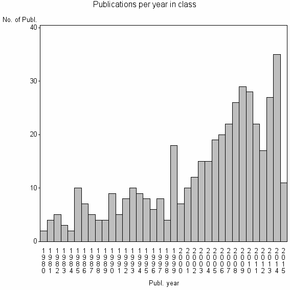
| 19314 | 446 | 33.2 | 47% |
Classes in level above (level 2) |
| ID, lev. above |
Publications | Label for level above |
|---|---|---|
| 76 | 26792 | REMOTE SENSING//IMAGING SCIENCE & PHOTOGRAPHIC TECHNOLOGY//REMOTE SENSING OF ENVIRONMENT |
Terms with highest relevance score |
| Rank | Term | Type of term | Relevance score (tfidf) |
Class's shr. of term's tot. occurrences |
Shr. of publ. in class containing term |
Num. of publ. in class |
|---|---|---|---|---|---|---|
| 1 | COLOR INFRARED PHOTOGRAPHY | Author keyword | 10 | 58% | 2% | 11 |
| 2 | INTEGRATED FARMING NAT OURCES | Address | 9 | 83% | 1% | 5 |
| 3 | CONVENTIONAL COLOR VIDEO IMAGERY | Author keyword | 6 | 80% | 1% | 4 |
| 4 | GIANT REED | Author keyword | 6 | 23% | 5% | 24 |
| 5 | AIRBORNE CHARGE COUPLED DEVICES | Author keyword | 6 | 100% | 1% | 4 |
| 6 | ARUNDO DONAX | Author keyword | 5 | 19% | 5% | 24 |
| 7 | INTEGRATED FARMING NAT OURCES UNIT | Address | 5 | 30% | 3% | 13 |
| 8 | SPATIAL ANAL GRP | Address | 4 | 67% | 1% | 4 |
| 9 | COLOR INFRARED VIDEO IMAGERY | Author keyword | 4 | 75% | 1% | 3 |
| 10 | FALSE COLOR IMAGERY | Author keyword | 4 | 75% | 1% | 3 |
Web of Science journal categories |
Author Key Words |
Key Words Plus |
| Rank | Web of Science journal category | Relevance score (tfidf) |
Class's shr. of term's tot. occurrences |
Shr. of publ. in class containing term |
Num. of publ. in class |
|---|---|---|---|---|---|
| 1 | HYMENOPTERA EURYTOMIDAE | 21 | 90% | 2% | 9 |
| 2 | TETRAMESA ROMANA | 21 | 90% | 2% | 9 |
| 3 | GIANT REED | 18 | 47% | 6% | 28 |
| 4 | MULTISPECTRAL DIGITAL IMAGERY | 11 | 56% | 3% | 14 |
| 5 | HAWKWEED HIERACIUM PRATENSE | 7 | 64% | 2% | 7 |
| 6 | MULTISPECTRAL VIDEO | 6 | 100% | 1% | 4 |
| 7 | MAPPING WEEDS | 5 | 47% | 2% | 8 |
| 8 | TAMARISK TAMARIX CHINENSIS | 4 | 75% | 1% | 3 |
| 9 | PHENOLOGICAL STAGE | 3 | 100% | 1% | 3 |
| 10 | HEMIPTERA DIASPIDIDAE | 2 | 44% | 1% | 4 |
Journals |
Reviews |
| Title | Publ. year | Cit. | Active references | % act. ref. to same field |
|---|---|---|---|---|
| Benefits of hyperspectral remote sensing for tracking plant invasions | 2011 | 37 | 68 | 29% |
| Remote-sensing and mapping of weeds in crops | 2001 | 75 | 43 | 33% |
| Applications of Remote Sensing to Alien Invasive Plant Studies | 2009 | 32 | 73 | 23% |
| Applications and research using remote sensing for rangeland management | 2003 | 73 | 94 | 24% |
| ARUNDO DONAX L., A CANDIDATE FOR PHYTOMANAGING WATER AND SOILS CONTAMINATED BY TRACE ELEMENTS AND PRODUCING PLANT-BASED FEEDSTOCK. A REVIEW | 2014 | 2 | 129 | 19% |
| Habitat suitability modelling of an invasive plant with advanced remote sensing data | 2009 | 29 | 91 | 12% |
| Detection Thresholds for Rare, Spectrally Unique Targets within Semiarid Rangelands | 2010 | 3 | 17 | 29% |
| Fuelling genetic and metabolic exploration of C-3 bioenergy crops through the first reference transcriptome of Arundo donax L. | 2014 | 3 | 95 | 8% |
| Review of the techniques of remote sensing as subsidy to the studies of implanted forest in Brazil | 2007 | 0 | 5 | 40% |
| A simplified method for retrieval of ground level reflectance of targets from airborne video imagery | 2001 | 4 | 9 | 33% |
Address terms |
| Rank | Address term | Relevance score (tfidf) |
Class's shr. of term's tot. occurrences |
Shr. of publ. in class containing term |
Num. of publ. in class |
|---|---|---|---|---|---|
| 1 | INTEGRATED FARMING NAT OURCES | 9 | 83% | 1.1% | 5 |
| 2 | INTEGRATED FARMING NAT OURCES UNIT | 5 | 30% | 2.9% | 13 |
| 3 | SPATIAL ANAL GRP | 4 | 67% | 0.9% | 4 |
| 4 | REMOTE SENSING M PING SCI | 4 | 35% | 2.0% | 9 |
| 5 | AGR BOT PLANT PHYSIOL BIOTECHNOL | 2 | 67% | 0.4% | 2 |
| 6 | HUDSON RIVER NERR NYSDEC | 1 | 100% | 0.4% | 2 |
| 7 | EXOT INVAS WEEDS UNIT | 1 | 10% | 2.5% | 11 |
| 8 | ECON ANAL STAT | 1 | 30% | 0.7% | 3 |
| 9 | GIS TRAINING | 1 | 18% | 0.9% | 4 |
| 10 | DIPARTIMENTO SCI BIOAGROALIMENTARI DISBA | 1 | 50% | 0.2% | 1 |
Related classes at same level (level 1) |
| Rank | Relatedness score | Related classes |
|---|---|---|
| 1 | 0.0000165032 | WEED DETECTION//AUTOMATIC GUIDANCE//AGRICULTURAL ROBOTICS |
| 2 | 0.0000162218 | VEGETATION INDICES//VEGETATION INDEX//AGR REMOTE SENSING INFORMAT SYST PLICAT |
| 3 | 0.0000134256 | PATHOMETRY//PHYTOPATOMETRY//PHYTOPATHOMETRY |
| 4 | 0.0000113358 | PHOTOGRAMMETRIC RECORD//CASTELLDEFELS TELECOMMUN AEROSP ENGN//FLUVIAL REMOTE SENSING |
| 5 | 0.0000104448 | HISTORICAL IMAGERY//AERIAL INFRARED THERMOGRAPHY//CONSERVATION ASSESSMENT AND PLANNING |
| 6 | 0.0000103641 | SPECTRAL VARIATION HYPOTHESIS//DYNAMIC HABITAT INDEX//BIOLOGICAL RICHNESS |
| 7 | 0.0000103555 | NON PHOTOSYNTHETIC VEGETATION//CROP RESIDUE COVER//CELLULOSE ABSORPTION INDEX CAI |
| 8 | 0.0000092796 | MARINE REMOTE SENSING//WATER COLUMN CORRECTION//BIOPHYS REMOTE SENSING GRP |
| 9 | 0.0000081991 | 3D GEOLOGIC MODEL//CAREX PSEUDOCURAICA//DISASTER PREVENT FLUVIAL MARINE DISAST |
| 10 | 0.0000081609 | ROBEL POLE//RISING PLATE METER//POINT FRAME |