Class information for: |
Basic class information |
| ID | Publications | Average number of references |
Avg. shr. active ref. in WoS |
|---|---|---|---|
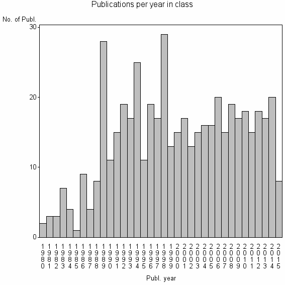
| 18084 | 504 | 30.5 | 46% |
Classes in level above (level 2) |
| ID, lev. above |
Publications | Label for level above |
|---|---|---|
| 76 | 26792 | REMOTE SENSING//IMAGING SCIENCE & PHOTOGRAPHIC TECHNOLOGY//REMOTE SENSING OF ENVIRONMENT |
Terms with highest relevance score |
| Rank | Term | Type of term | Relevance score (tfidf) |
Class's shr. of term's tot. occurrences |
Shr. of publ. in class containing term |
Num. of publ. in class |
|---|---|---|---|---|---|---|
| 1 | FRACTAL MEASUREMENT | Author keyword | 4 | 75% | 1% | 3 |
| 2 | OPTIMAL SPATIAL RESOLUTION | Author keyword | 3 | 100% | 1% | 3 |
| 3 | RESOLUTION TRANSFORMATION MODEL | Author keyword | 3 | 100% | 1% | 3 |
| 4 | DIVIDER METHOD | Author keyword | 3 | 50% | 1% | 4 |
| 5 | BIOSTAT SPATIAL PROC UNIT | Address | 2 | 67% | 0% | 2 |
| 6 | MODERATE SPATIAL RESOLUTION | Author keyword | 2 | 67% | 0% | 2 |
| 7 | VARIOGRAM METHOD | Author keyword | 2 | 50% | 1% | 3 |
| 8 | ISARITHM | Author keyword | 1 | 100% | 0% | 2 |
| 9 | ISARITHM METHOD | Author keyword | 1 | 100% | 0% | 2 |
| 10 | FOREST DEFINITION | Author keyword | 1 | 27% | 1% | 3 |
Web of Science journal categories |
Author Key Words |
| Rank | Web of Science journal category | Relevance score (tfidf) |
Class's shr. of term's tot. occurrences |
Shr. of publ. in class containing term |
Num. of publ. in class |
LCSH search | Wikipedia search |
|---|---|---|---|---|---|---|---|
| 1 | FRACTAL MEASUREMENT | 4 | 75% | 1% | 3 | Search FRACTAL+MEASUREMENT | Search FRACTAL+MEASUREMENT |
| 2 | OPTIMAL SPATIAL RESOLUTION | 3 | 100% | 1% | 3 | Search OPTIMAL+SPATIAL+RESOLUTION | Search OPTIMAL+SPATIAL+RESOLUTION |
| 3 | RESOLUTION TRANSFORMATION MODEL | 3 | 100% | 1% | 3 | Search RESOLUTION+TRANSFORMATION+MODEL | Search RESOLUTION+TRANSFORMATION+MODEL |
| 4 | DIVIDER METHOD | 3 | 50% | 1% | 4 | Search DIVIDER+METHOD | Search DIVIDER+METHOD |
| 5 | MODERATE SPATIAL RESOLUTION | 2 | 67% | 0% | 2 | Search MODERATE+SPATIAL+RESOLUTION | Search MODERATE+SPATIAL+RESOLUTION |
| 6 | VARIOGRAM METHOD | 2 | 50% | 1% | 3 | Search VARIOGRAM+METHOD | Search VARIOGRAM+METHOD |
| 7 | ISARITHM | 1 | 100% | 0% | 2 | Search ISARITHM | Search ISARITHM |
| 8 | ISARITHM METHOD | 1 | 100% | 0% | 2 | Search ISARITHM+METHOD | Search ISARITHM+METHOD |
| 9 | FOREST DEFINITION | 1 | 27% | 1% | 3 | Search FOREST+DEFINITION | Search FOREST+DEFINITION |
| 10 | SEMIVARIOGRAM ANALYSIS | 1 | 21% | 1% | 3 | Search SEMIVARIOGRAM+ANALYSIS | Search SEMIVARIOGRAM+ANALYSIS |
Key Words Plus |
| Rank | Web of Science journal category | Relevance score (tfidf) |
Class's shr. of term's tot. occurrences |
Shr. of publ. in class containing term |
Num. of publ. in class |
|---|---|---|---|---|---|
| 1 | TOPOGRAPHIC SURFACES | 18 | 56% | 4% | 22 |
| 2 | VARIOGRAMS | 10 | 22% | 8% | 42 |
| 3 | AVERAGE LOCAL VARIANCE | 9 | 83% | 1% | 5 |
| 4 | GEOGRAPHICAL ENTITIES | 6 | 44% | 2% | 11 |
| 5 | REMOTE SENSING INVESTIGATIONS | 6 | 71% | 1% | 5 |
| 6 | SEMIVARIOGRAM | 6 | 34% | 3% | 15 |
| 7 | GROUND BASED RADIOMETRY | 5 | 60% | 1% | 6 |
| 8 | AIRBORNE MSS IMAGERY | 5 | 63% | 1% | 5 |
| 9 | FORESTED ENVIRONMENT | 4 | 35% | 2% | 9 |
| 10 | STATISTICAL SELF SIMILARITY | 3 | 35% | 1% | 7 |
Journals |
Reviews |
| Title | Publ. year | Cit. | Active references |
% act. ref. to same field |
|---|---|---|---|---|
| Remote-sensing image analysis and geostatistics | 2012 | 31 | 93 | 41% |
| Geostatistics and remote sensing | 1998 | 117 | 74 | 61% |
| Fractal analysis of remotely sensed images: A review of methods and applications | 2006 | 64 | 73 | 38% |
| Spatial scale problems and geostatistical solutions: A review | 2000 | 80 | 31 | 48% |
| Remote Sensing Classification Using Fractal Dimensions over a Subtropical Hilly Region | 2011 | 1 | 19 | 63% |
| Remote sensing in strategic applications | 2001 | 0 | 6 | 67% |
| Integrating Remote Sensing and Wavelet Analysis for Studying Fine-scaled Vegetation Spatial Variation among Three Different Ecosystems | 2012 | 2 | 29 | 24% |
Address terms |
| Rank | Address term | Relevance score (tfidf) |
Class's shr. of term's tot. occurrences |
Shr. of publ. in class containing term |
Num. of publ. in class |
|---|---|---|---|---|---|
| 1 | BIOSTAT SPATIAL PROC UNIT | 2 | 67% | 0.4% | 2 |
| 2 | CARTOG REMOTE SENSING STUDY PROGRAM | 1 | 50% | 0.2% | 1 |
| 3 | CHANGCHUN JINGYUETAN REMOTE SENSING TEST SITE | 1 | 50% | 0.2% | 1 |
| 4 | GEOINFORMAT PROC REMOTE SENSING | 1 | 50% | 0.2% | 1 |
| 5 | INVEST INGN ELECT IIIE UNS CONICET | 1 | 50% | 0.2% | 1 |
| 6 | MARITIME PROV SPATIAL ANAL | 1 | 50% | 0.2% | 1 |
| 7 | NERC EQUIPMENT POOL FIELD SPECT | 1 | 50% | 0.2% | 1 |
| 8 | RIVERS SERV LLC 5 | 1 | 50% | 0.2% | 1 |
| 9 | UMR TETIS CEMAGREF | 1 | 50% | 0.2% | 1 |
| 10 | UMR114 | 1 | 50% | 0.2% | 1 |
Related classes at same level (level 1) |
| Rank | Relatedness score | Related classes |
|---|---|---|
| 1 | 0.0000146856 | HYPERSPECTRAL IMAGE CLASSIFICATION//ACTIVE LEARNING AL//HYPERSPECTRAL IMAGE HSI CLASSIFICATION |
| 2 | 0.0000129748 | LANDSCAPE METRICS//LANDSCAPE ECOLOGY//LANDSCAPE PATTERN ANALYSIS |
| 3 | 0.0000117628 | GLOBAL LAND COVER//SW GEOG SCI//RSU |
| 4 | 0.0000113443 | 3D GEOLOGIC MODEL//CAREX PSEUDOCURAICA//DISASTER PREVENT FLUVIAL MARINE DISAST |
| 5 | 0.0000111735 | FRACTAL ANALYSIS//LACUNARITY//SUCCOLARITY |
| 6 | 0.0000111379 | IMPERVIOUS SURFACE//CARTOG GIS GRP//IMPERVIOUS SURFACE ESTIMATION |
| 7 | 0.0000101622 | MILITARY LANDS//ECOL MANAGEMENT MIL LANDS//MILITARY DISTURBANCE |
| 8 | 0.0000096727 | HISTORICAL IMAGERY//AERIAL INFRARED THERMOGRAPHY//CONSERVATION ASSESSMENT AND PLANNING |
| 9 | 0.0000094909 | DEFORMATION RELIEF//REGIONAL OIL EXPLOITATION//JERS 1 OPS |
| 10 | 0.0000082531 | DIGITAL SOIL MAPPING//PEDOMETRICS//REGRESSION KRIGING |