Class information for: |
Basic class information |
| ID | Publications | Average number of references |
Avg. shr. active ref. in WoS |
|---|---|---|---|
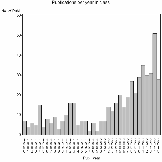
| 18062 | 506 | 31.2 | 47% |
Classes in level above (level 2) |
| ID, lev. above |
Publications | Label for level above |
|---|---|---|
| 76 | 26792 | REMOTE SENSING//IMAGING SCIENCE & PHOTOGRAPHIC TECHNOLOGY//REMOTE SENSING OF ENVIRONMENT |
Terms with highest relevance score |
| Rank | Term | Type of term | Relevance score (tfidf) |
Class's shr. of term's tot. occurrences |
Shr. of publ. in class containing term |
Num. of publ. in class |
|---|---|---|---|---|---|---|
| 1 | CROP YIELD FORECASTING | Author keyword | 8 | 75% | 1% | 6 |
| 2 | WEATHER YIELD MODEL | Author keyword | 3 | 100% | 1% | 3 |
| 3 | MONITORING TIME | Author keyword | 2 | 67% | 0% | 2 |
| 4 | WATER SAVING AGR ARID AREA CHINA | Address | 2 | 67% | 0% | 2 |
| 5 | ACGEO | Address | 1 | 100% | 0% | 2 |
| 6 | AGROMETSHELL MODEL | Author keyword | 1 | 100% | 0% | 2 |
| 7 | ICCYF | Author keyword | 1 | 100% | 0% | 2 |
| 8 | LAI BRIDGE | Author keyword | 1 | 100% | 0% | 2 |
| 9 | MANAGERIAL | Address | 1 | 50% | 0% | 2 |
| 10 | MODIS APPLICATION | Author keyword | 1 | 100% | 0% | 2 |
Web of Science journal categories |
Author Key Words |
| Rank | Web of Science journal category | Relevance score (tfidf) |
Class's shr. of term's tot. occurrences |
Shr. of publ. in class containing term |
Num. of publ. in class |
LCSH search | Wikipedia search |
|---|---|---|---|---|---|---|---|
| 1 | CROP YIELD FORECASTING | 8 | 75% | 1% | 6 | Search CROP+YIELD+FORECASTING | Search CROP+YIELD+FORECASTING |
| 2 | WEATHER YIELD MODEL | 3 | 100% | 1% | 3 | Search WEATHER+YIELD+MODEL | Search WEATHER+YIELD+MODEL |
| 3 | MONITORING TIME | 2 | 67% | 0% | 2 | Search MONITORING+TIME | Search MONITORING+TIME |
| 4 | AGROMETSHELL MODEL | 1 | 100% | 0% | 2 | Search AGROMETSHELL+MODEL | Search AGROMETSHELL+MODEL |
| 5 | ICCYF | 1 | 100% | 0% | 2 | Search ICCYF | Search ICCYF |
| 6 | LAI BRIDGE | 1 | 100% | 0% | 2 | Search LAI+BRIDGE | Search LAI+BRIDGE |
| 7 | MODIS APPLICATION | 1 | 100% | 0% | 2 | Search MODIS+APPLICATION | Search MODIS+APPLICATION |
| 8 | MODRY | 1 | 100% | 0% | 2 | Search MODRY | Search MODRY |
| 9 | WHEAT YIELD ESTIMATION | 1 | 50% | 0% | 2 | Search WHEAT+YIELD+ESTIMATION | Search WHEAT+YIELD+ESTIMATION |
| 10 | FORMOSAT 2 | 1 | 18% | 1% | 6 | Search FORMOSAT+2 | Search FORMOSAT+2 |
Key Words Plus |
| Rank | Web of Science journal category | Relevance score (tfidf) |
Class's shr. of term's tot. occurrences |
Shr. of publ. in class containing term |
Num. of publ. in class |
|---|---|---|---|---|---|
| 1 | PARAMETERIZED MODEL | 9 | 83% | 1% | 5 |
| 2 | FORMOSAT 2 IMAGES | 5 | 63% | 1% | 5 |
| 3 | WHEAT YIELD | 4 | 13% | 5% | 27 |
| 4 | YIELD ESTIMATION | 3 | 21% | 3% | 13 |
| 5 | GRAMINEOUS CROP GROWTH | 2 | 67% | 0% | 2 |
| 6 | RADAR SATELLITE DATA | 2 | 67% | 0% | 2 |
| 7 | VEGETATION HEALTH INDEXES | 2 | 67% | 0% | 2 |
| 8 | YAQUI VALLEY | 2 | 67% | 0% | 2 |
| 9 | CERES MAIZE MODEL | 2 | 19% | 1% | 7 |
| 10 | SENSING DATA ASSIMILATION | 1 | 38% | 1% | 3 |
Journals |
Reviews |
| Title | Publ. year | Cit. | Active references | % act. ref. to same field |
|---|---|---|---|---|
| Remote sensing-based global crop monitoring: experiences with China's CropWatch system | 2014 | 5 | 16 | 38% |
| Using Low Resolution Satellite Imagery for Yield Prediction and Yield Anomaly Detection | 2013 | 17 | 85 | 33% |
| Advances in Remote Sensing of Agriculture: Context Description, Existing Operational Monitoring Systems and Major Information Needs | 2013 | 46 | 92 | 13% |
| Combining agricultural crop models and satellite observations: from field to regional scales | 1998 | 167 | 41 | 32% |
| Prediction of crop yield, water consumption and water use efficiency with a SVAT-crop growth model using remotely sensed data on the North China Plain | 2005 | 99 | 87 | 10% |
| Remote Sensing and Geospatial Technological Applications for Site-specific Management of Fruit and Nut Crops: A Review | 2010 | 4 | 34 | 21% |
| Modelling of the effect of dry periods on yielding of spring barley | 2010 | 2 | 8 | 13% |
| Earth observation satellite sensors for biodiversity monitoring: potentials and bottlenecks | 2014 | 2 | 121 | 4% |
| On correlation of maize and wheat yield with NDVI: Example of Hungary (1985-1998) | 2002 | 6 | 8 | 13% |
| Coupling a grassland ecosystem model with Landsat imagery for a 10-year simulation of carbon and water budgets | 2001 | 40 | 68 | 6% |
Address terms |
| Rank | Address term | Relevance score (tfidf) |
Class's shr. of term's tot. occurrences |
Shr. of publ. in class containing term |
Num. of publ. in class |
|---|---|---|---|---|---|
| 1 | WATER SAVING AGR ARID AREA CHINA | 2 | 67% | 0.4% | 2 |
| 2 | ACGEO | 1 | 100% | 0.4% | 2 |
| 3 | MANAGERIAL | 1 | 50% | 0.4% | 2 |
| 4 | CEPAGRI | 1 | 27% | 0.8% | 4 |
| 5 | ENVIRONM OURCES MANAGEMENT CITY PLANNIN | 1 | 40% | 0.4% | 2 |
| 6 | REMOTE SENSING METEOROL | 1 | 40% | 0.4% | 2 |
| 7 | KEY OPEN ARID CLIMATE CHANGE DISASTER REDUC | 1 | 33% | 0.4% | 2 |
| 8 | AGR ENVIRONM SCI PROD LANDSC E AGROENER | 1 | 50% | 0.2% | 1 |
| 9 | CHIAYI BRANCH STN | 1 | 50% | 0.2% | 1 |
| 10 | CSCRS | 1 | 50% | 0.2% | 1 |
Related classes at same level (level 1) |
| Rank | Relatedness score | Related classes |
|---|---|---|
| 1 | 0.0000231372 | VEGETATION INDICES//VEGETATION INDEX//AGR REMOTE SENSING INFORMAT SYST PLICAT |
| 2 | 0.0000196565 | GLOBAL LAND COVER//SW GEOG SCI//RSU |
| 3 | 0.0000158132 | PHENOLOGY//NDVI//LEAF UNFOLDING |
| 4 | 0.0000113437 | DSSAT//CERES WHEAT//CROPSYST |
| 5 | 0.0000110779 | WEATHER INDICES//SPAW MODEL//TECHNOLOGY TREND |
| 6 | 0.0000106550 | LEAF AREA INDEX//CLUMPING INDEX//LAI 2000 |
| 7 | 0.0000086684 | 3D GEOLOGIC MODEL//CAREX PSEUDOCURAICA//DISASTER PREVENT FLUVIAL MARINE DISAST |
| 8 | 0.0000075164 | STANDARDIZED PRECIPITATION INDEX//DROUGHT MITIGAT//STANDARDIZED PRECIPITATION INDEX SPI |
| 9 | 0.0000069105 | CHANGE DETECTION//LANDSAT//STARFM |
| 10 | 0.0000063954 | BAND SIMULATION//GROUND OBJECT SPECTRUM//DESERT ZONES MANAGEMENT |