Class information for: |
Basic class information |
| ID | Publications | Average number of references |
Avg. shr. active ref. in WoS |
|---|---|---|---|
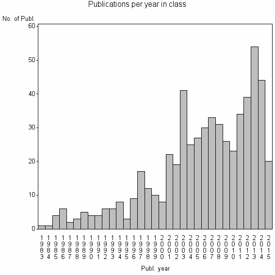
| 16675 | 577 | 36.8 | 53% |
Classes in level above (level 2) |
| ID, lev. above |
Publications | Label for level above |
|---|---|---|
| 76 | 26792 | REMOTE SENSING//IMAGING SCIENCE & PHOTOGRAPHIC TECHNOLOGY//REMOTE SENSING OF ENVIRONMENT |
Terms with highest relevance score |
| Rank | Term | Type of term | Relevance score (tfidf) |
Class's shr. of term's tot. occurrences |
Shr. of publ. in class containing term |
Num. of publ. in class |
|---|---|---|---|---|---|---|
| 1 | MARINE REMOTE SENSING | Address | 8 | 39% | 3% | 16 |
| 2 | WATER COLUMN CORRECTION | Author keyword | 6 | 71% | 1% | 5 |
| 3 | BIOPHYS REMOTE SENSING GRP | Address | 5 | 31% | 2% | 13 |
| 4 | SPATIAL ENVIRONM | Address | 3 | 18% | 2% | 14 |
| 5 | SPE AL | Address | 3 | 60% | 1% | 3 |
| 6 | TROP COASTAL MANAGEMENT STUDIES | Address | 2 | 32% | 1% | 6 |
| 7 | BATHYMETRY RETRIEVAL | Author keyword | 2 | 67% | 0% | 2 |
| 8 | BOTTOM ALBEDO | Author keyword | 2 | 67% | 0% | 2 |
| 9 | URA 1152 CNRS | Address | 2 | 67% | 0% | 2 |
| 10 | SUBMERGED AQUATIC VEGETATION SAV | Author keyword | 2 | 30% | 1% | 6 |
Web of Science journal categories |
Author Key Words |
| Rank | Web of Science journal category | Relevance score (tfidf) |
Class's shr. of term's tot. occurrences |
Shr. of publ. in class containing term |
Num. of publ. in class |
LCSH search | Wikipedia search |
|---|---|---|---|---|---|---|---|
| 1 | WATER COLUMN CORRECTION | 6 | 71% | 1% | 5 | Search WATER+COLUMN+CORRECTION | Search WATER+COLUMN+CORRECTION |
| 2 | BATHYMETRY RETRIEVAL | 2 | 67% | 0% | 2 | Search BATHYMETRY+RETRIEVAL | Search BATHYMETRY+RETRIEVAL |
| 3 | BOTTOM ALBEDO | 2 | 67% | 0% | 2 | Search BOTTOM+ALBEDO | Search BOTTOM+ALBEDO |
| 4 | SUBMERGED AQUATIC VEGETATION SAV | 2 | 30% | 1% | 6 | Search SUBMERGED+AQUATIC+VEGETATION+SAV | Search SUBMERGED+AQUATIC+VEGETATION+SAV |
| 5 | LIVE CORAL COVER | 2 | 50% | 1% | 3 | Search LIVE+CORAL+COVER | Search LIVE+CORAL+COVER |
| 6 | BENTHIC HABITAT MAPPING | 1 | 21% | 1% | 6 | Search BENTHIC+HABITAT+MAPPING | Search BENTHIC+HABITAT+MAPPING |
| 7 | BATHYMETRY MAPPING | 1 | 50% | 0% | 2 | Search BATHYMETRY+MAPPING | Search BATHYMETRY+MAPPING |
| 8 | POSIDONIA OCEANICA MAPPING | 1 | 100% | 0% | 2 | Search POSIDONIA+OCEANICA+MAPPING | Search POSIDONIA+OCEANICA+MAPPING |
| 9 | REFLECTANCE RATE | 1 | 100% | 0% | 2 | Search REFLECTANCE+RATE | Search REFLECTANCE+RATE |
| 10 | XINCUN BAY | 1 | 50% | 0% | 2 | Search XINCUN+BAY | Search XINCUN+BAY |
Key Words Plus |
| Rank | Web of Science journal category | Relevance score (tfidf) |
Class's shr. of term's tot. occurrences |
Shr. of publ. in class containing term |
Num. of publ. in class |
|---|---|---|---|---|---|
| 1 | BOTTOM TYPES | 26 | 87% | 2% | 13 |
| 2 | SPECTRAL DISCRIMINATION | 18 | 39% | 6% | 37 |
| 3 | SHALLOW WATERS | 16 | 30% | 8% | 44 |
| 4 | IKONOS DATA | 14 | 65% | 2% | 13 |
| 5 | GENERALIZED RATIO ASSUMPTION | 13 | 80% | 1% | 8 |
| 6 | REEF BENTHIC COMMUNITIES | 12 | 75% | 2% | 9 |
| 7 | SHALLOW WATER BATHYMETRY | 7 | 56% | 2% | 9 |
| 8 | CORAL REEF ENVIRONMENTS | 6 | 100% | 1% | 4 |
| 9 | SUN GLINT | 6 | 50% | 1% | 8 |
| 10 | TROPICAL COASTAL RESOURCES | 5 | 54% | 1% | 7 |
Journals |
Reviews |
| Title | Publ. year | Cit. | Active references | % act. ref. to same field |
|---|---|---|---|---|
| The application of remote sensing to seagrass ecosystems: an overview and future research prospects | 2015 | 2 | 201 | 46% |
| Water Column Correction for Coral Reef Studies by Remote Sensing | 2014 | 3 | 71 | 72% |
| Remote sensing of coral reefs and their physical environment | 2004 | 98 | 40 | 68% |
| A review of remote sensing for the assessment and management of tropical coastal resources | 1996 | 117 | 29 | 34% |
| Progress in the use of remote sensing for coral reef biodiversity studies | 2007 | 17 | 68 | 38% |
| Using very high resolution remote sensing for the management of coral reef fisheries: Review and perspectives | 2010 | 12 | 65 | 26% |
| The application of remote sensing for marine protected area management | 2014 | 2 | 85 | 13% |
| Biological and remote sensing perspectives of pigmentation in coral reef organisms | 2002 | 34 | 66 | 24% |
| Northern Florida reef tract benthic metabolism scaled by remote sensing | 2006 | 6 | 60 | 30% |
| The scientific issues surrounding remote detection of submerged coral ecosystems | 1998 | 17 | 55 | 27% |
Address terms |
| Rank | Address term | Relevance score (tfidf) |
Class's shr. of term's tot. occurrences |
Shr. of publ. in class containing term |
Num. of publ. in class |
|---|---|---|---|---|---|
| 1 | MARINE REMOTE SENSING | 8 | 39% | 2.8% | 16 |
| 2 | BIOPHYS REMOTE SENSING GRP | 5 | 31% | 2.3% | 13 |
| 3 | SPATIAL ENVIRONM | 3 | 18% | 2.4% | 14 |
| 4 | SPE AL | 3 | 60% | 0.5% | 3 |
| 5 | TROP COASTAL MANAGEMENT STUDIES | 2 | 32% | 1.0% | 6 |
| 6 | URA 1152 CNRS | 2 | 67% | 0.3% | 2 |
| 7 | REMOTE SENSING SPATIAL INFORMAT SCI | 2 | 16% | 1.7% | 10 |
| 8 | WATERLOO EARTH OBSERV | 2 | 43% | 0.5% | 3 |
| 9 | ENVIRONM REMOTE SENSING GRP | 1 | 18% | 1.0% | 6 |
| 10 | CAMBRIDGE COASTAL UNIT | 1 | 13% | 1.0% | 6 |
Related classes at same level (level 1) |
| Rank | Relatedness score | Related classes |
|---|---|---|
| 1 | 0.0000160969 | OCEAN COLOR//REMOTE SENSING REFLECTANCE//SEAWIFS |
| 2 | 0.0000153119 | PHOTOGRAMMETRIC RECORD//CASTELLDEFELS TELECOMMUN AEROSP ENGN//FLUVIAL REMOTE SENSING |
| 3 | 0.0000135420 | SHORELINE CHANGE//COASTAL VULNERABILITY INDEX//SHORELINE CHANGE RATES |
| 4 | 0.0000129399 | SEAFLOOR CLASSIFICATION//ACOUSTIC SEABED CLASSIFICATION//MULTIBEAM BACKSCATTER |
| 5 | 0.0000094664 | SEAGRASS//ZOSTERA MARINA//POSIDONIA OCEANICA |
| 6 | 0.0000092796 | COLOR INFRARED PHOTOGRAPHY//INTEGRATED FARMING NAT OURCES//CONVENTIONAL COLOR VIDEO IMAGERY |
| 7 | 0.0000084146 | CORAL REEFS//CORAL REEF//CORAL RECRUITMENT |
| 8 | 0.0000081768 | PYRAMIDELLIDAE//GIANT CLAM//GIANT CLAMS |
| 9 | 0.0000077589 | EARTH PLANETARY REMOTE SENSING//RADAR ALTIMETRY//SPACE INFORMAT TECHNOL SYST |
| 10 | 0.0000075644 | REEF ISLANDS//REEF ISLAND//ATOLL LAGOON |