Class information for: |
Basic class information |
| ID | Publications | Average number of references |
Avg. shr. active ref. in WoS |
|---|---|---|---|
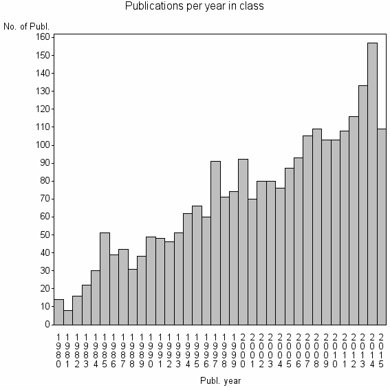
| 1514 | 2530 | 36.2 | 60% |
Classes in level above (level 2) |
| ID, lev. above |
Publications | Label for level above |
|---|---|---|
| 76 | 26792 | REMOTE SENSING//IMAGING SCIENCE & PHOTOGRAPHIC TECHNOLOGY//REMOTE SENSING OF ENVIRONMENT |
Terms with highest relevance score |
| Rank | Term | Type of term | Relevance score (tfidf) |
Class's shr. of term's tot. occurrences |
Shr. of publ. in class containing term |
Num. of publ. in class |
|---|---|---|---|---|---|---|
| 1 | LEAF AREA INDEX | Author keyword | 50 | 18% | 10% | 260 |
| 2 | CLUMPING INDEX | Author keyword | 50 | 81% | 1% | 30 |
| 3 | LAI 2000 | Author keyword | 46 | 70% | 2% | 38 |
| 4 | HEMISPHERICAL PHOTOGRAPHY | Author keyword | 39 | 50% | 2% | 56 |
| 5 | GAP FRACTION | Author keyword | 39 | 57% | 2% | 46 |
| 6 | LEAF AREA INDEX LAI | Author keyword | 34 | 35% | 3% | 78 |
| 7 | LAI | Author keyword | 24 | 18% | 5% | 118 |
| 8 | LEAF ANGLE DISTRIBUTION | Author keyword | 22 | 81% | 1% | 13 |
| 9 | PLANT CANOPY ANALYZER | Author keyword | 18 | 89% | 0% | 8 |
| 10 | MULTI ANGLE REMOTE SENSING | Author keyword | 16 | 61% | 1% | 17 |
Web of Science journal categories |
Author Key Words |
| Rank | Web of Science journal category | Relevance score (tfidf) |
Class's shr. of term's tot. occurrences |
Shr. of publ. in class containing term |
Num. of publ. in class |
LCSH search | Wikipedia search |
|---|---|---|---|---|---|---|---|
| 1 | LEAF AREA INDEX | 50 | 18% | 10% | 260 | Search LEAF+AREA+INDEX | Search LEAF+AREA+INDEX |
| 2 | CLUMPING INDEX | 50 | 81% | 1% | 30 | Search CLUMPING+INDEX | Search CLUMPING+INDEX |
| 3 | LAI 2000 | 46 | 70% | 2% | 38 | Search LAI+2000 | Search LAI+2000 |
| 4 | HEMISPHERICAL PHOTOGRAPHY | 39 | 50% | 2% | 56 | Search HEMISPHERICAL+PHOTOGRAPHY | Search HEMISPHERICAL+PHOTOGRAPHY |
| 5 | GAP FRACTION | 39 | 57% | 2% | 46 | Search GAP+FRACTION | Search GAP+FRACTION |
| 6 | LEAF AREA INDEX LAI | 34 | 35% | 3% | 78 | Search LEAF+AREA+INDEX+LAI | Search LEAF+AREA+INDEX+LAI |
| 7 | LAI | 24 | 18% | 5% | 118 | Search LAI | Search LAI |
| 8 | LEAF ANGLE DISTRIBUTION | 22 | 81% | 1% | 13 | Search LEAF+ANGLE+DISTRIBUTION | Search LEAF+ANGLE+DISTRIBUTION |
| 9 | PLANT CANOPY ANALYZER | 18 | 89% | 0% | 8 | Search PLANT+CANOPY+ANALYZER | Search PLANT+CANOPY+ANALYZER |
| 10 | MULTI ANGLE REMOTE SENSING | 16 | 61% | 1% | 17 | Search MULTI+ANGLE+REMOTE+SENSING | Search MULTI+ANGLE+REMOTE+SENSING |
Key Words Plus |
| Rank | Web of Science journal category | Relevance score (tfidf) |
Class's shr. of term's tot. occurrences |
Shr. of publ. in class containing term |
Num. of publ. in class |
|---|---|---|---|---|---|
| 1 | BIDIRECTIONAL REFLECTANCE | 157 | 39% | 13% | 320 |
| 2 | LEAF AREA INDEX | 102 | 19% | 19% | 492 |
| 3 | HEMISPHERICAL PHOTOGRAPHY | 93 | 56% | 5% | 115 |
| 4 | MISR DATA | 86 | 77% | 2% | 58 |
| 5 | LAI | 72 | 40% | 5% | 138 |
| 6 | DIRECT SUNLIGHT | 71 | 84% | 2% | 38 |
| 7 | LAI PRODUCTS | 65 | 90% | 1% | 28 |
| 8 | VEGETATION CANOPIES | 52 | 35% | 5% | 120 |
| 9 | LAI 2000 | 49 | 82% | 1% | 28 |
| 10 | PHOTOSYNTHETICALLY ACTIVE RADIATION | 48 | 28% | 6% | 146 |
Journals |
Reviews |
| Title | Publ. year | Cit. | Active references | % act. ref. to same field |
|---|---|---|---|---|
| Review of methods for in situ leaf area index determination - Part I. Theories, sensors and hemispherical photography | 2004 | 451 | 68 | 75% |
| Review of methods for in situ leaf area index (LAI) determination Part II. Estimation of LAI, errors and sampling | 2004 | 270 | 50 | 98% |
| Validation and intercomparison of global Leaf Area Index products derived from remote sensing data | 2008 | 124 | 79 | 67% |
| Ground-based measurements of leaf area index: a review of methods, instruments and current controversies | 2003 | 330 | 80 | 71% |
| Retrieving Leaf Area Index (LAI) Using Remote Sensing: Theories, Methods and Sensors | 2009 | 65 | 100 | 42% |
| Review of ground-based methods to measure the distribution of biomass in forest canopies | 2011 | 13 | 89 | 58% |
| Direct and indirect estimation of leaf area index, f(APAR), and net primary production of terrestrial ecosystems | 1999 | 495 | 91 | 23% |
| Digital hemispherical photography for estimating forest canopy properties: current controversies and opportunities | 2012 | 2 | 40 | 100% |
| Review of Available Products of Leaf Area Index and Their Suitability over the Formerly Soviet Central Asia | 2012 | 4 | 41 | 76% |
| A light model for spatially explicit forest stand models | 1998 | 114 | 100 | 59% |
Address terms |
| Rank | Address term | Relevance score (tfidf) |
Class's shr. of term's tot. occurrences |
Shr. of publ. in class containing term |
Num. of publ. in class |
|---|---|---|---|---|---|
| 1 | SOIL SCI REMOTE SENSING SOILS | 15 | 88% | 0.3% | 7 |
| 2 | GLOBAL ENVIRONM MONITORING UNIT | 6 | 26% | 0.8% | 20 |
| 3 | BEIJING REMOTE SENSING ENVIRONM DIGITAL | 6 | 28% | 0.7% | 17 |
| 4 | REMOTE SENSING S | 4 | 15% | 1.0% | 26 |
| 5 | GEOG REMOTE SENSING UNIT | 4 | 75% | 0.1% | 3 |
| 6 | IMAGE PROC UCG IPL | 4 | 75% | 0.1% | 3 |
| 7 | UMR CNES | 3 | 57% | 0.2% | 4 |
| 8 | ENVIRONM REMOTE SENSING UNIT | 3 | 100% | 0.1% | 3 |
| 9 | GRP RECH TELEDETECT SPATIALISAT | 3 | 100% | 0.1% | 3 |
| 10 | PROGRAM PLANNING | 3 | 12% | 1.0% | 25 |
Related classes at same level (level 1) |
| Rank | Relatedness score | Related classes |
|---|---|---|
| 1 | 0.0000184438 | SPECTRAL BRIGHTNESS COEFFICIENTS//EARLY WINTER SEEDING//POLARIZATION REMOTE SENSING |
| 2 | 0.0000161357 | VEGETATION INDICES//VEGETATION INDEX//AGR REMOTE SENSING INFORMAT SYST PLICAT |
| 3 | 0.0000133357 | TOPOGRAPHIC CORRECTION//MINNAERT//ADJACENCY EFFECT |
| 4 | 0.0000106550 | CROP YIELD FORECASTING//WEATHER YIELD MODEL//MONITORING TIME |
| 5 | 0.0000084210 | AIRBORNE LASER SCANNING//LIDAR//FOREST INVENTORY |
| 6 | 0.0000077398 | PHENOLOGY//NDVI//LEAF UNFOLDING |
| 7 | 0.0000071353 | SCI EXPLORAT DIRECTORATE//RELATIVE SPECTRAL RESPONSE RSR//THERMAL EMISSIVE BANDS TEBS |
| 8 | 0.0000070826 | FRACTAL MEASUREMENT//OPTIMAL SPATIAL RESOLUTION//RESOLUTION TRANSFORMATION MODEL |
| 9 | 0.0000069799 | BRANCHINESS//PIPE MODEL THEORY//SAPWOOD WIDTH |
| 10 | 0.0000066188 | EDDY COVARIANCE//NET ECOSYSTEM EXCHANGE//ECOSYSTEM RESPIRATION |