Class information for: |
Basic class information |
| ID | Publications | Average number of references |
Avg. shr. active ref. in WoS |
|---|---|---|---|
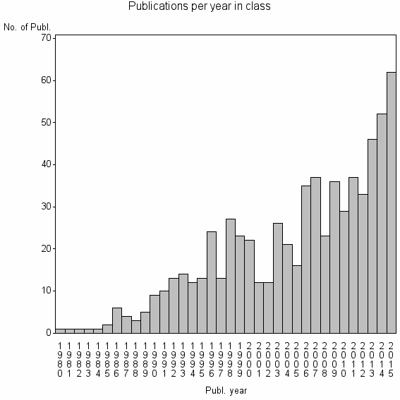
| 14759 | 682 | 32.0 | 35% |
Classes in level above (level 2) |
| ID, lev. above |
Publications | Label for level above |
|---|---|---|
| 399 | 16137 | GROUND WATER//HYDROGEOLOGY JOURNAL//SUBMARINE GROUNDWATER DISCHARGE |
Terms with highest relevance score |
| Rank | Term | Type of term | Relevance score (tfidf) |
Class's shr. of term's tot. occurrences |
Shr. of publ. in class containing term |
Num. of publ. in class |
|---|---|---|---|---|---|---|
| 1 | DRASTIC | Author keyword | 104 | 76% | 11% | 74 |
| 2 | GROUNDWATER VULNERABILITY | Author keyword | 68 | 64% | 10% | 67 |
| 3 | DRASTIC MODEL | Author keyword | 41 | 87% | 3% | 20 |
| 4 | VULNERABILITY MAPPING | Author keyword | 28 | 62% | 4% | 29 |
| 5 | AQUIFER VULNERABILITY | Author keyword | 24 | 50% | 5% | 34 |
| 6 | DRASTIC INDEX | Author keyword | 15 | 82% | 1% | 9 |
| 7 | COP METHOD | Author keyword | 12 | 86% | 1% | 6 |
| 8 | GROUNDWATER VULNERABILITY ASSESSMENT | Author keyword | 8 | 70% | 1% | 7 |
| 9 | DRASTIC METHOD | Author keyword | 8 | 75% | 1% | 6 |
| 10 | GALDIT | Author keyword | 6 | 80% | 1% | 4 |
Web of Science journal categories |
Author Key Words |
| Rank | Web of Science journal category | Relevance score (tfidf) |
Class's shr. of term's tot. occurrences |
Shr. of publ. in class containing term |
Num. of publ. in class |
LCSH search | Wikipedia search |
|---|---|---|---|---|---|---|---|
| 1 | DRASTIC | 104 | 76% | 11% | 74 | Search DRASTIC | Search DRASTIC |
| 2 | GROUNDWATER VULNERABILITY | 68 | 64% | 10% | 67 | Search GROUNDWATER+VULNERABILITY | Search GROUNDWATER+VULNERABILITY |
| 3 | DRASTIC MODEL | 41 | 87% | 3% | 20 | Search DRASTIC+MODEL | Search DRASTIC+MODEL |
| 4 | VULNERABILITY MAPPING | 28 | 62% | 4% | 29 | Search VULNERABILITY+MAPPING | Search VULNERABILITY+MAPPING |
| 5 | AQUIFER VULNERABILITY | 24 | 50% | 5% | 34 | Search AQUIFER+VULNERABILITY | Search AQUIFER+VULNERABILITY |
| 6 | DRASTIC INDEX | 15 | 82% | 1% | 9 | Search DRASTIC+INDEX | Search DRASTIC+INDEX |
| 7 | COP METHOD | 12 | 86% | 1% | 6 | Search COP+METHOD | Search COP+METHOD |
| 8 | GROUNDWATER VULNERABILITY ASSESSMENT | 8 | 70% | 1% | 7 | Search GROUNDWATER+VULNERABILITY+ASSESSMENT | Search GROUNDWATER+VULNERABILITY+ASSESSMENT |
| 9 | DRASTIC METHOD | 8 | 75% | 1% | 6 | Search DRASTIC+METHOD | Search DRASTIC+METHOD |
| 10 | GALDIT | 6 | 80% | 1% | 4 | Search GALDIT | Search GALDIT |
Key Words Plus |
| Rank | Web of Science journal category | Relevance score (tfidf) |
Class's shr. of term's tot. occurrences |
Shr. of publ. in class containing term |
Num. of publ. in class |
|---|---|---|---|---|---|
| 1 | DRASTIC MODEL | 85 | 86% | 6% | 43 |
| 2 | AQUIFER VULNERABILITY | 75 | 74% | 8% | 55 |
| 3 | EUROPEAN APPROACH | 32 | 88% | 2% | 15 |
| 4 | ISRAELS SHARON REGION | 31 | 92% | 2% | 12 |
| 5 | GROUNDWATER VULNERABILITY | 28 | 55% | 5% | 36 |
| 6 | ASSESSING AQUIFER VULNERABILITY | 20 | 100% | 1% | 9 |
| 7 | GROUNDWATER VULNERABILITY ASSESSMENT | 13 | 80% | 1% | 8 |
| 8 | INTRINSIC VULNERABILITY | 11 | 67% | 1% | 10 |
| 9 | MODIFIED DRASTIC MODEL | 9 | 83% | 1% | 5 |
| 10 | SHIJIAZHUANG CITY | 9 | 83% | 1% | 5 |
Journals |
Reviews |
| Title | Publ. year | Cit. | Active references | % act. ref. to same field |
|---|---|---|---|---|
| GIS-based DRASTIC method for groundwater vulnerability assessment: a review | 2012 | 15 | 44 | 59% |
| Groundwater Vulnerability Assessment of Plant Protection Products: A Review | 2010 | 9 | 62 | 50% |
| A GIS-based susceptibility indexing method for irrigation and drinking water management planning: Application to Chebba-Mellouleche Aquifer, Tunisia | 2009 | 8 | 6 | 67% |
| Review of the impact of the 1999 Water Regulation in reducing Cryptosporidium contamination risk in groundwater public supplies | 2007 | 0 | 1 | 100% |
| The 1999 cryptosporidium risk assessment exercise in England and Wales - A groudwater overview | 2005 | 1 | 2 | 100% |
| Monitoring nonpoint source pollutants in the vadose zone with GIS | 1997 | 57 | 139 | 15% |
| MOVEMENT OF SELECTED PESTICIDES AND HERBICIDES THROUGH COLUMNS OF SANDY LOAM | 1986 | 4 | 3 | 33% |
Address terms |
| Rank | Address term | Relevance score (tfidf) |
Class's shr. of term's tot. occurrences |
Shr. of publ. in class containing term |
Num. of publ. in class |
|---|---|---|---|---|---|
| 1 | FO TRY SCI LANDSC E ARCHITECTURE | 3 | 100% | 0.4% | 3 |
| 2 | WATER ENERGY ENVIRONM LR3E | 2 | 30% | 0.9% | 6 |
| 3 | ENVIRONM SCI LAND USE PLANNING GENIE RURAL | 1 | 100% | 0.3% | 2 |
| 4 | M TECH INC | 1 | 100% | 0.3% | 2 |
| 5 | GROUNDWATER CONTAMINATED LAND | 1 | 40% | 0.3% | 2 |
| 6 | HAUTE ECOLE INGN GEST CANTON VAUD | 1 | 40% | 0.3% | 2 |
| 7 | SEZ GEOL PLICATA | 1 | 40% | 0.3% | 2 |
| 8 | NEBRASKA WATER | 1 | 27% | 0.4% | 3 |
| 9 | PEDOL GEOL | 1 | 25% | 0.4% | 3 |
| 10 | CANADA CHAIR QUANTITAT HYDROGEOL FRACTURED PO | 1 | 50% | 0.1% | 1 |
Related classes at same level (level 1) |
| Rank | Relatedness score | Related classes |
|---|---|---|
| 1 | 0.0000167892 | NITRATE SOURCES//NITRATE ISOTOPES//NITRATE SOURCE |
| 2 | 0.0000154376 | PESTICIDE LEACHING//PESTICIDE ROOT ZONE MODEL//POCER |
| 3 | 0.0000113818 | GROUNDWATER POTENTIAL ZONES//LINEAMENT//GROUNDWATER POTENTIAL |
| 4 | 0.0000096680 | KARST//KARST AQUIFER//KARST HYDROLOGY |
| 5 | 0.0000078734 | GROUNDWATER QUALITY//HYDROCHEMISTRY//HYDROGEOCHEMISTRY |
| 6 | 0.0000074920 | URBAN GROUNDWATER//SEWER LEAKAGE//MARKER SPECIES |
| 7 | 0.0000070911 | CURVE NUMBER//SCS CN METHOD//INITIAL ABSTRACTION RATIO |
| 8 | 0.0000070143 | GROUNDWATER QUALITY MONITORING//WINVAST//TRANSINFORMATION |
| 9 | 0.0000068870 | DRAM PROD TECHNOL//INT CHEM STUDIES//POINT SOURCE MODELING |
| 10 | 0.0000065448 | AGRI ENVIRONMENTAL POLICY EVALUATION//LEHRSTUHL UMWELTGEOL//GROUNDWATER RESIDENCE TIMES |