Class information for: |
Basic class information |
| ID | Publications | Average number of references |
Avg. shr. active ref. in WoS |
|---|---|---|---|
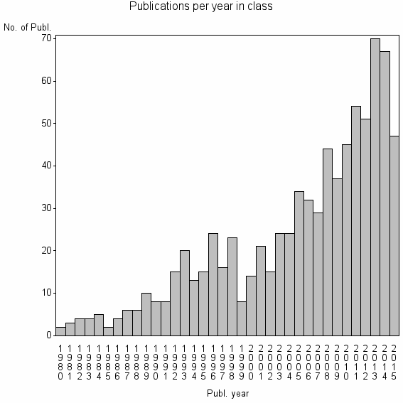
| 12985 | 804 | 33.2 | 35% |
Classes in level above (level 2) |
Terms with highest relevance score |
| Rank | Term | Type of term | Relevance score (tfidf) |
Class's shr. of term's tot. occurrences |
Shr. of publ. in class containing term |
Num. of publ. in class |
|---|---|---|---|---|---|---|
| 1 | LANDFILL SITE SELECTION | Author keyword | 17 | 79% | 1% | 11 |
| 2 | LANDFILL SITING | Author keyword | 16 | 64% | 2% | 16 |
| 3 | LAND EVALUATION | Author keyword | 13 | 29% | 5% | 39 |
| 4 | LAND SUITABILITY | Author keyword | 12 | 33% | 4% | 30 |
| 5 | MICROLEIS DSS | Author keyword | 8 | 100% | 1% | 5 |
| 6 | MICROLEIS | Author keyword | 6 | 80% | 0% | 4 |
| 7 | MULTI CRITERIA EVALUATION | Author keyword | 5 | 18% | 3% | 26 |
| 8 | SITE SELECTION | Author keyword | 5 | 10% | 6% | 48 |
| 9 | GEO OURCES GEOHAZARDS GRP | Address | 4 | 75% | 0% | 3 |
| 10 | LAND USE SUITABILITY | Author keyword | 3 | 39% | 1% | 7 |
Web of Science journal categories |
Author Key Words |
| Rank | Web of Science journal category | Relevance score (tfidf) |
Class's shr. of term's tot. occurrences |
Shr. of publ. in class containing term |
Num. of publ. in class |
LCSH search | Wikipedia search |
|---|---|---|---|---|---|---|---|
| 1 | LANDFILL SITE SELECTION | 17 | 79% | 1% | 11 | Search LANDFILL+SITE+SELECTION | Search LANDFILL+SITE+SELECTION |
| 2 | LANDFILL SITING | 16 | 64% | 2% | 16 | Search LANDFILL+SITING | Search LANDFILL+SITING |
| 3 | LAND EVALUATION | 13 | 29% | 5% | 39 | Search LAND+EVALUATION | Search LAND+EVALUATION |
| 4 | LAND SUITABILITY | 12 | 33% | 4% | 30 | Search LAND+SUITABILITY | Search LAND+SUITABILITY |
| 5 | MICROLEIS DSS | 8 | 100% | 1% | 5 | Search MICROLEIS+DSS | Search MICROLEIS+DSS |
| 6 | MICROLEIS | 6 | 80% | 0% | 4 | Search MICROLEIS | Search MICROLEIS |
| 7 | MULTI CRITERIA EVALUATION | 5 | 18% | 3% | 26 | Search MULTI+CRITERIA+EVALUATION | Search MULTI+CRITERIA+EVALUATION |
| 8 | SITE SELECTION | 5 | 10% | 6% | 48 | Search SITE+SELECTION | Search SITE+SELECTION |
| 9 | LAND USE SUITABILITY | 3 | 39% | 1% | 7 | Search LAND+USE+SUITABILITY | Search LAND+USE+SUITABILITY |
| 10 | SPATIAL MULTICRITERIA EVALUATION | 3 | 100% | 0% | 3 | Search SPATIAL+MULTICRITERIA+EVALUATION | Search SPATIAL+MULTICRITERIA+EVALUATION |
Key Words Plus |
| Rank | Web of Science journal category | Relevance score (tfidf) |
Class's shr. of term's tot. occurrences |
Shr. of publ. in class containing term |
Num. of publ. in class |
|---|---|---|---|---|---|
| 1 | SITING MSW LANDFILLS | 45 | 94% | 2% | 16 |
| 2 | LAND SUITABILITY | 15 | 56% | 2% | 18 |
| 3 | GEOGRAPHICAL INFORMATION SYSTEMS | 15 | 19% | 9% | 69 |
| 4 | USE SUITABILITY ANALYSIS | 11 | 47% | 2% | 17 |
| 5 | MULTICRITERIA EVALUATION | 10 | 20% | 6% | 46 |
| 6 | SUITABILITY ANALYSIS | 9 | 45% | 2% | 15 |
| 7 | LANDFILL SITE SELECTION | 8 | 62% | 1% | 8 |
| 8 | MICROLEIS DSS | 6 | 100% | 0% | 4 |
| 9 | ARCGIS | 5 | 63% | 1% | 5 |
| 10 | LAND EVALUATION | 3 | 27% | 1% | 11 |
Journals |
Reviews |
| Title | Publ. year | Cit. | Active references |
% act. ref. to same field |
|---|---|---|---|---|
| Multiple stakeholders in multi-criteria decision-making in the context of Municipal Solid Waste Management: A review | 2015 | 2 | 71 | 32% |
| GIS-based approach for optimized siting of municipal solid waste landfill | 2008 | 65 | 18 | 72% |
| GIS-based multicriteria decision analysis: a survey of the literature | 2006 | 238 | 88 | 38% |
| GIS-based multicriteria municipal solid waste landfill suitability analysis: A review of the methodologies performed and criteria implemented | 2014 | 2 | 42 | 90% |
| GIS-based land-use suitability analysis: a critical overview | 2004 | 241 | 43 | 33% |
| GIS-based analytic hierarchy process as a multicriteria decision analysis instrument: a review | 2013 | 6 | 31 | 58% |
| Hazardous waste management system in india: An overview | 2008 | 4 | 3 | 100% |
| Integrating multi-criteria techniques with geographical information systems in waste facility location to enhance public participation | 2006 | 40 | 52 | 54% |
| Municipal solid waste management using Geographical Information System aided methods: A mini review | 2014 | 1 | 82 | 48% |
| Applications of remote sensing and GIS for sustainable management of shrimp culture in India | 2007 | 28 | 25 | 32% |
Address terms |
| Rank | Address term | Relevance score (tfidf) |
Class's shr. of term's tot. occurrences |
Shr. of publ. in class containing term |
Num. of publ. in class |
|---|---|---|---|---|---|
| 1 | GEO OURCES GEOHAZARDS GRP | 4 | 75% | 0.4% | 3 |
| 2 | MARINE BIO OURCE ENVIRONM SENSING | 2 | 26% | 0.9% | 7 |
| 3 | SCI TECHNOL FISHERIES INFRASTRUCT SYST | 1 | 100% | 0.2% | 2 |
| 4 | GEOSPATIAL INFORMAT SCI GIS RC | 1 | 40% | 0.2% | 2 |
| 5 | NAT OURCES AGROBIOL IRNAS | 1 | 40% | 0.2% | 2 |
| 6 | AGR FO T FISHERIES | 1 | 50% | 0.1% | 1 |
| 7 | ECOLE DOCTORALE ABIES | 1 | 50% | 0.1% | 1 |
| 8 | FISHERIES INFORMAT | 1 | 50% | 0.1% | 1 |
| 9 | GEOG ORDENA TERRITORIO | 1 | 50% | 0.1% | 1 |
| 10 | GEOSPATIAL INFORMAT SYST ENGN | 1 | 50% | 0.1% | 1 |
Related classes at same level (level 1) |
| Rank | Relatedness score | Related classes |
|---|---|---|
| 1 | 0.0000181520 | DYNAMIC SITE RESPONSE ANALYSIS//ENGINEERING GEOLOGICAL//FULLY MECHANIZED SUBLEVEL CAVING |
| 2 | 0.0000137102 | LUPIS//MODELING TO GENERATE ALTERNATIVES//BURRUYACU DISTRICT |
| 3 | 0.0000097080 | URBAN GROWTH//GEOMOD//SLEUTH |
| 4 | 0.0000091168 | PPGIS//PARTICIPATORY GIS//PUBLIC PARTICIPATION GIS |
| 5 | 0.0000090655 | ANALYTIC HIERARCHY PROCESS//FUZZY AHP//PAIRWISE COMPARISONS |
| 6 | 0.0000082348 | ETHNOPEDOLOGY//LOCAL SOIL KNOWLEDGE//SOIL SCI PROGRAMME |
| 7 | 0.0000082105 | MULTIPLE CRITERIA SORTING//ADDITIVE VALUE FUNCTION//PREFERENCE DISAGGREGATION |
| 8 | 0.0000075881 | GREENWAYS//GREENWAY PLANNING//GREENWAY |
| 9 | 0.0000072614 | HISTORICAL IMAGERY//AERIAL INFRARED THERMOGRAPHY//CONSERVATION ASSESSMENT AND PLANNING |
| 10 | 0.0000066238 | POLITICAL DISTRICTING//DISTRICTING//TERRITORY DESIGN |